You are here: Home > Network List > CN - Canadian National Seismograph Network Stations List
> Station INK INUVIK, NT > Earthquake Result Viewer
INK INUVIK, NT - Earthquake Result Viewer
*The percent match for this event was below the threshold and hence no stack was calculated.
| Earthquake location: |
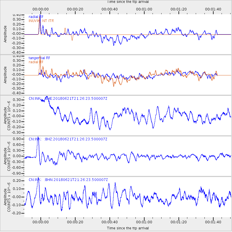
Vanuatu Islands |
| Earthquake latitude/longitude: |
-17.8/168.0 |
| Earthquake time(UTC): |
2018/06/21 (172) 21:13:32 GMT |
| Earthquake Depth: |
22 km |
| Earthquake Magnitude: |
6.1 Mww |
| Earthquake Catalog/Contributor: |
NEIC PDE/us |
|
| Network: |
CN Canadian National Seismograph Network |
| Station: |
INK INUVIK, NT |
| Lat/Lon: |
68.31 N/133.53 W |
| Elevation: |
44 m |
|
| Distance: |
95.6 deg |
| Az: |
18.563 deg |
| Baz: |
234.654 deg |
| Ray Param: |
$rayparam |
*The percent match for this event was below the threshold and hence was not used in the summary stack. |
|
| Radial Match: |
57.26776 % |
| Radial Bump: |
400 |
| Transverse Match: |
42.690536 % |
| Transverse Bump: |
400 |
| SOD ConfigId: |
13570011 |
| Insert Time: |
2019-04-30 10:31:09.551 +0000 |
| GWidth: |
2.5 |
| Max Bumps: |
400 |
| Tol: |
0.001 |
|
Signal To Noise
| Channel | StoN | STA | LTA |
| CN:INK: :BHZ:20180621T21:26:23.500007Z | 3.758939 | 2.1398166E-7 | 5.6926083E-8 |
| CN:INK: :BHN:20180621T21:26:23.500007Z | 1.1352764 | 6.113335E-8 | 5.384886E-8 |
| CN:INK: :BHE:20180621T21:26:23.500007Z | 1.0621588 | 1.5870678E-7 | 1.4941907E-7 |
| Arrivals |
| Ps | |
| PpPs | |
| PsPs/PpSs | |


