You are here: Home > Network List > TA - USArray Transportable Network (new EarthScope stations) Stations List
> Station H31M Peel River, Yukon, CAN > Earthquake Result Viewer
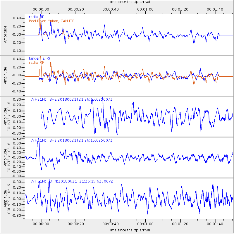
H31M Peel River, Yukon, CAN - Earthquake Result Viewer
*The percent match for this event was below the threshold and hence no stack was calculated.
| Earthquake location: |
Vanuatu Islands |
| Earthquake latitude/longitude: |
-17.8/168.0 |
| Earthquake time(UTC): |
2018/06/21 (172) 21:13:32 GMT |
| Earthquake Depth: |
22 km |
| Earthquake Magnitude: |
6.1 Mww |
| Earthquake Catalog/Contributor: |
NEIC PDE/us |
|
| Network: |
TA USArray Transportable Network (new EarthScope stations) |
| Station: |
H31M Peel River, Yukon, CAN |
| Lat/Lon: |
65.81 N/134.34 W |
| Elevation: |
642 m |
|
| Distance: |
93.8 deg |
| Az: |
20.42 deg |
| Baz: |
233.75 deg |
| Ray Param: |
$rayparam |
*The percent match for this event was below the threshold and hence was not used in the summary stack. |
|
| Radial Match: |
77.09533 % |
| Radial Bump: |
400 |
| Transverse Match: |
60.118427 % |
| Transverse Bump: |
400 |
| SOD ConfigId: |
13570011 |
| Insert Time: |
2019-04-30 10:34:28.903 +0000 |
| GWidth: |
2.5 |
| Max Bumps: |
400 |
| Tol: |
0.001 |
|
Signal To Noise
| Channel | StoN | STA | LTA |
| TA:H31M: :BHZ:20180621T21:26:15.625007Z | 3.8557584 | 2.4278378E-7 | 6.296655E-8 |
| TA:H31M: :BHN:20180621T21:26:15.625007Z | 2.9319541 | 1.6290628E-7 | 5.5562356E-8 |
| TA:H31M: :BHE:20180621T21:26:15.625007Z | 1.7125013 | 1.7552351E-7 | 1.024954E-7 |
| Arrivals |
| Ps | |
| PpPs | |
| PsPs/PpSs | |


