You are here: Home > Network List > TA - USArray Transportable Network (new EarthScope stations) Stations List
> Station P17K Kvichak River, AK, USA > Earthquake Result Viewer
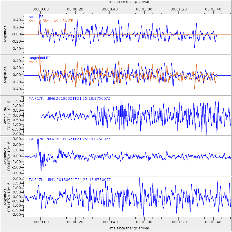
P17K Kvichak River, AK, USA - Earthquake Result Viewer
*The percent match for this event was below the threshold and hence no stack was calculated.
| Earthquake location: |
Vanuatu Islands |
| Earthquake latitude/longitude: |
-17.8/168.0 |
| Earthquake time(UTC): |
2018/06/21 (172) 21:13:32 GMT |
| Earthquake Depth: |
22 km |
| Earthquake Magnitude: |
6.1 Mww |
| Earthquake Catalog/Contributor: |
NEIC PDE/us |
|
| Network: |
TA USArray Transportable Network (new EarthScope stations) |
| Station: |
P17K Kvichak River, AK, USA |
| Lat/Lon: |
59.20 N/156.44 W |
| Elevation: |
91 m |
|
| Distance: |
82.1 deg |
| Az: |
17.58 deg |
| Baz: |
213.991 deg |
| Ray Param: |
$rayparam |
*The percent match for this event was below the threshold and hence was not used in the summary stack. |
|
| Radial Match: |
76.703354 % |
| Radial Bump: |
400 |
| Transverse Match: |
66.39734 % |
| Transverse Bump: |
400 |
| SOD ConfigId: |
13570011 |
| Insert Time: |
2019-04-30 10:35:32.461 +0000 |
| GWidth: |
2.5 |
| Max Bumps: |
400 |
| Tol: |
0.001 |
|
Signal To Noise
| Channel | StoN | STA | LTA |
| TA:P17K: :BHZ:20180621T21:25:18.875007Z | 13.458879 | 1.0428294E-6 | 7.7482625E-8 |
| TA:P17K: :BHN:20180621T21:25:18.875007Z | 3.219714 | 5.619465E-7 | 1.7453304E-7 |
| TA:P17K: :BHE:20180621T21:25:18.875007Z | 2.081986 | 4.7176573E-7 | 2.2659411E-7 |
| Arrivals |
| Ps | |
| PpPs | |
| PsPs/PpSs | |


