You are here: Home > Network List > UW - Pacific Northwest Regional Seismic Network Stations List
> Station LEBA Lebam, WA, USA > Earthquake Result Viewer
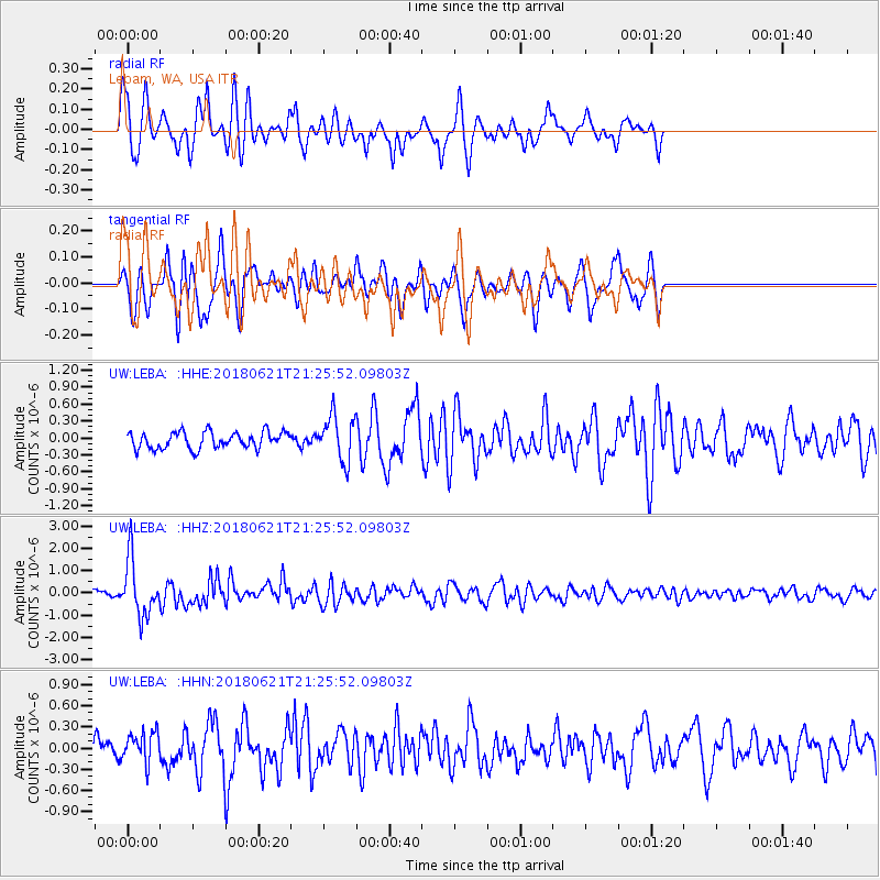
LEBA Lebam, WA, USA - Earthquake Result Viewer
*The percent match for this event was below the threshold and hence no stack was calculated.
| Earthquake location: |
Vanuatu Islands |
| Earthquake latitude/longitude: |
-17.8/168.0 |
| Earthquake time(UTC): |
2018/06/21 (172) 21:13:32 GMT |
| Earthquake Depth: |
22 km |
| Earthquake Magnitude: |
6.1 Mww |
| Earthquake Catalog/Contributor: |
NEIC PDE/us |
|
| Network: |
UW Pacific Northwest Regional Seismic Network |
| Station: |
LEBA Lebam, WA, USA |
| Lat/Lon: |
46.55 N/123.56 W |
| Elevation: |
73 m |
|
| Distance: |
88.8 deg |
| Az: |
39.937 deg |
| Baz: |
242.378 deg |
| Ray Param: |
$rayparam |
*The percent match for this event was below the threshold and hence was not used in the summary stack. |
|
| Radial Match: |
72.495964 % |
| Radial Bump: |
362 |
| Transverse Match: |
67.67701 % |
| Transverse Bump: |
400 |
| SOD ConfigId: |
13570011 |
| Insert Time: |
2019-04-30 10:36:48.465 +0000 |
| GWidth: |
2.5 |
| Max Bumps: |
400 |
| Tol: |
0.001 |
|
Signal To Noise
| Channel | StoN | STA | LTA |
| UW:LEBA: :HHZ:20180621T21:25:52.09803Z | 12.383883 | 1.272877E-6 | 1.0278495E-7 |
| UW:LEBA: :HHN:20180621T21:25:52.09803Z | 1.4872102 | 2.1914245E-7 | 1.4735137E-7 |
| UW:LEBA: :HHE:20180621T21:25:52.09803Z | 2.8856223 | 4.1736956E-7 | 1.4463762E-7 |
| Arrivals |
| Ps | |
| PpPs | |
| PsPs/PpSs | |


