You are here: Home > Network List > CI - Caltech Regional Seismic Network Stations List
> Station MPM Manuel Prospect Mine, California, USA > Earthquake Result Viewer
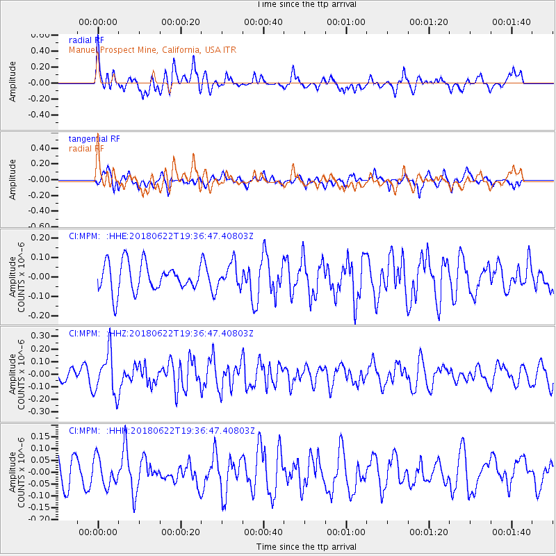
MPM Manuel Prospect Mine, California, USA - Earthquake Result Viewer
*The percent match for this event was below the threshold and hence no stack was calculated.
| Earthquake location: |
Solomon Islands |
| Earthquake latitude/longitude: |
-10.0/161.7 |
| Earthquake time(UTC): |
2018/06/22 (173) 19:24:30 GMT |
| Earthquake Depth: |
43 km |
| Earthquake Magnitude: |
5.4 Mww |
| Earthquake Catalog/Contributor: |
NEIC PDE/us |
|
| Network: |
CI Caltech Regional Seismic Network |
| Station: |
MPM Manuel Prospect Mine, California, USA |
| Lat/Lon: |
36.06 N/117.49 W |
| Elevation: |
185 m |
|
| Distance: |
88.5 deg |
| Az: |
53.156 deg |
| Baz: |
256.588 deg |
| Ray Param: |
$rayparam |
*The percent match for this event was below the threshold and hence was not used in the summary stack. |
|
| Radial Match: |
52.78119 % |
| Radial Bump: |
400 |
| Transverse Match: |
49.40597 % |
| Transverse Bump: |
400 |
| SOD ConfigId: |
13570011 |
| Insert Time: |
2019-04-30 10:40:10.503 +0000 |
| GWidth: |
2.5 |
| Max Bumps: |
400 |
| Tol: |
0.001 |
|
Signal To Noise
| Channel | StoN | STA | LTA |
| CI:MPM: :HHZ:20180622T19:36:47.40803Z | 2.5458503 | 1.710673E-7 | 6.719456E-8 |
| CI:MPM: :HHN:20180622T19:36:47.40803Z | 0.9114502 | 5.9626274E-8 | 6.541912E-8 |
| CI:MPM: :HHE:20180622T19:36:47.40803Z | 0.8380632 | 6.0228246E-8 | 7.186599E-8 |
| Arrivals |
| Ps | |
| PpPs | |
| PsPs/PpSs | |


