You are here: Home > Network List > TA - USArray Transportable Network (new EarthScope stations) Stations List
> Station E20K Nigu River, AK, USA > Earthquake Result Viewer
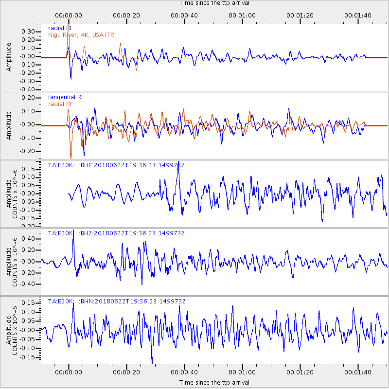
E20K Nigu River, AK, USA - Earthquake Result Viewer
*The percent match for this event was below the threshold and hence no stack was calculated.
| Earthquake location: |
Solomon Islands |
| Earthquake latitude/longitude: |
-10.0/161.7 |
| Earthquake time(UTC): |
2018/06/22 (173) 19:24:30 GMT |
| Earthquake Depth: |
43 km |
| Earthquake Magnitude: |
5.4 Mww |
| Earthquake Catalog/Contributor: |
NEIC PDE/us |
|
| Network: |
TA USArray Transportable Network (new EarthScope stations) |
| Station: |
E20K Nigu River, AK, USA |
| Lat/Lon: |
68.26 N/156.19 W |
| Elevation: |
866 m |
|
| Distance: |
83.6 deg |
| Az: |
14.575 deg |
| Baz: |
221.701 deg |
| Ray Param: |
$rayparam |
*The percent match for this event was below the threshold and hence was not used in the summary stack. |
|
| Radial Match: |
59.47044 % |
| Radial Bump: |
400 |
| Transverse Match: |
56.089516 % |
| Transverse Bump: |
400 |
| SOD ConfigId: |
13570011 |
| Insert Time: |
2019-04-30 10:42:41.812 +0000 |
| GWidth: |
2.5 |
| Max Bumps: |
400 |
| Tol: |
0.001 |
|
Signal To Noise
| Channel | StoN | STA | LTA |
| TA:E20K: :BHZ:20180622T19:36:23.149973Z | 3.602966 | 1.6715488E-7 | 4.6393687E-8 |
| TA:E20K: :BHN:20180622T19:36:23.149973Z | 1.5022941 | 5.522268E-8 | 3.6758905E-8 |
| TA:E20K: :BHE:20180622T19:36:23.149973Z | 1.0713441 | 3.6596507E-8 | 3.415943E-8 |
| Arrivals |
| Ps | |
| PpPs | |
| PsPs/PpSs | |


