You are here: Home > Network List > UW - Pacific Northwest Regional Seismic Network Stations List
> Station UMAT Pilot Rock, OR, USA > Earthquake Result Viewer
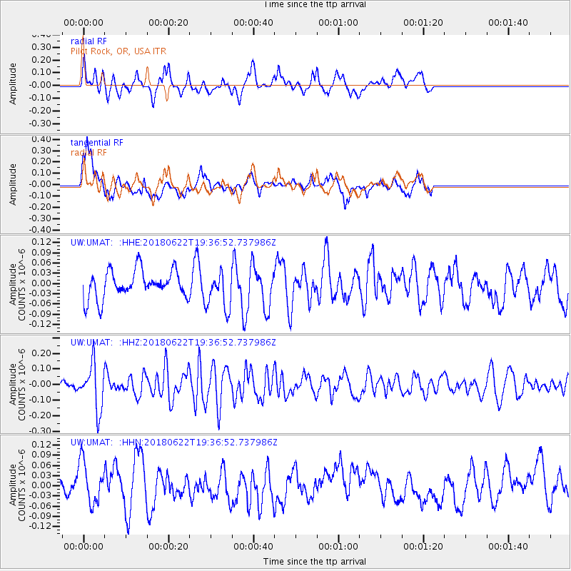
UMAT Pilot Rock, OR, USA - Earthquake Result Viewer
*The percent match for this event was below the threshold and hence no stack was calculated.
| Earthquake location: |
Solomon Islands |
| Earthquake latitude/longitude: |
-10.0/161.7 |
| Earthquake time(UTC): |
2018/06/22 (173) 19:24:30 GMT |
| Earthquake Depth: |
43 km |
| Earthquake Magnitude: |
5.4 Mww |
| Earthquake Catalog/Contributor: |
NEIC PDE/us |
|
| Network: |
UW Pacific Northwest Regional Seismic Network |
| Station: |
UMAT Pilot Rock, OR, USA |
| Lat/Lon: |
45.29 N/118.96 W |
| Elevation: |
1318 m |
|
| Distance: |
89.7 deg |
| Az: |
43.935 deg |
| Baz: |
255.488 deg |
| Ray Param: |
$rayparam |
*The percent match for this event was below the threshold and hence was not used in the summary stack. |
|
| Radial Match: |
61.291203 % |
| Radial Bump: |
400 |
| Transverse Match: |
60.034348 % |
| Transverse Bump: |
400 |
| SOD ConfigId: |
13570011 |
| Insert Time: |
2019-04-30 10:44:26.391 +0000 |
| GWidth: |
2.5 |
| Max Bumps: |
400 |
| Tol: |
0.001 |
|
Signal To Noise
| Channel | StoN | STA | LTA |
| UW:UMAT: :HHZ:20180622T19:36:52.737986Z | 3.6491039 | 1.4639171E-7 | 4.011717E-8 |
| UW:UMAT: :HHN:20180622T19:36:52.737986Z | 2.4505525 | 6.2812084E-8 | 2.5631804E-8 |
| UW:UMAT: :HHE:20180622T19:36:52.737986Z | 1.3748341 | 5.5548465E-8 | 4.0403762E-8 |
| Arrivals |
| Ps | |
| PpPs | |
| PsPs/PpSs | |


