You are here: Home > Network List > CI - Caltech Regional Seismic Network Stations List
> Station MPM Manuel Prospect Mine, California, USA > Earthquake Result Viewer
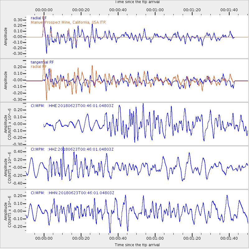
MPM Manuel Prospect Mine, California, USA - Earthquake Result Viewer
*The percent match for this event was below the threshold and hence no stack was calculated.
| Earthquake location: |
Solomon Islands |
| Earthquake latitude/longitude: |
-10.3/161.1 |
| Earthquake time(UTC): |
2018/06/23 (174) 00:33:39 GMT |
| Earthquake Depth: |
23 km |
| Earthquake Magnitude: |
5.5 Mww |
| Earthquake Catalog/Contributor: |
NEIC PDE/us |
|
| Network: |
CI Caltech Regional Seismic Network |
| Station: |
MPM Manuel Prospect Mine, California, USA |
| Lat/Lon: |
36.06 N/117.49 W |
| Elevation: |
185 m |
|
| Distance: |
89.1 deg |
| Az: |
53.251 deg |
| Baz: |
256.711 deg |
| Ray Param: |
$rayparam |
*The percent match for this event was below the threshold and hence was not used in the summary stack. |
|
| Radial Match: |
66.5245 % |
| Radial Bump: |
400 |
| Transverse Match: |
67.90951 % |
| Transverse Bump: |
400 |
| SOD ConfigId: |
13570011 |
| Insert Time: |
2019-04-30 10:47:33.893 +0000 |
| GWidth: |
2.5 |
| Max Bumps: |
400 |
| Tol: |
0.001 |
|
Signal To Noise
| Channel | StoN | STA | LTA |
| CI:MPM: :HHZ:20180623T00:46:01.04803Z | 1.607196 | 1.512578E-7 | 9.411285E-8 |
| CI:MPM: :HHN:20180623T00:46:01.04803Z | 1.0042669 | 6.572111E-8 | 6.5441874E-8 |
| CI:MPM: :HHE:20180623T00:46:01.04803Z | 1.5249852 | 7.7729936E-8 | 5.0970947E-8 |
| Arrivals |
| Ps | |
| PpPs | |
| PsPs/PpSs | |


