You are here: Home > Network List > TA - USArray Transportable Network (new EarthScope stations) Stations List
> Station L15K Ungalak Mountain, AK, USA > Earthquake Result Viewer
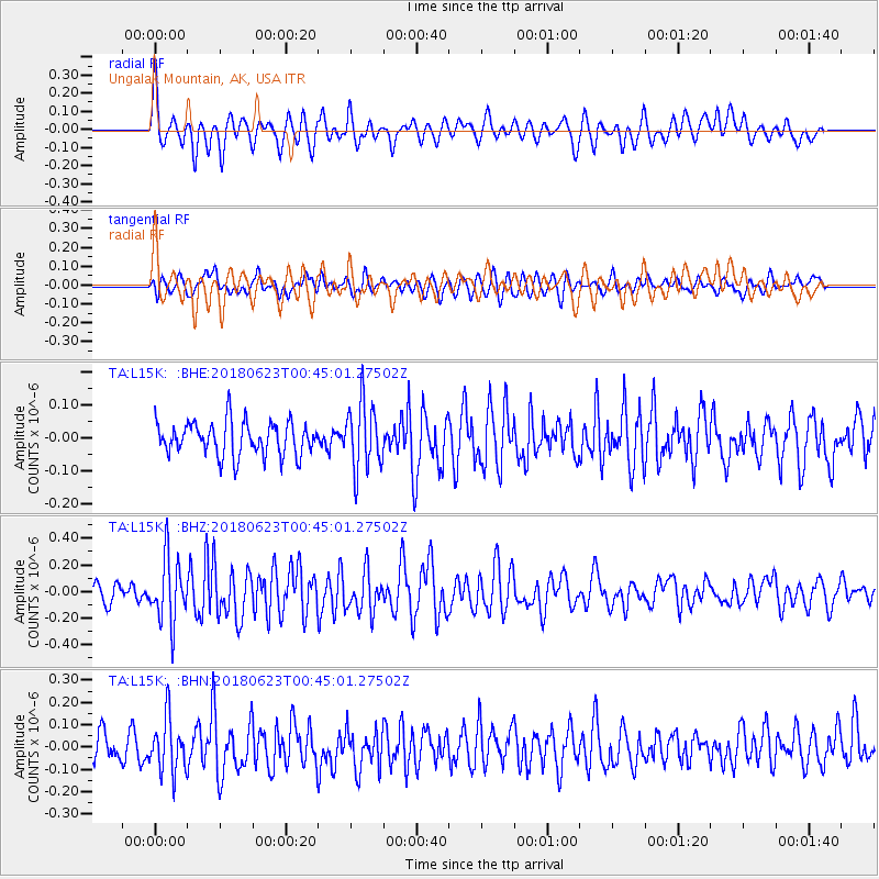
L15K Ungalak Mountain, AK, USA - Earthquake Result Viewer
*The percent match for this event was below the threshold and hence no stack was calculated.
| Earthquake location: |
Solomon Islands |
| Earthquake latitude/longitude: |
-10.3/161.1 |
| Earthquake time(UTC): |
2018/06/23 (174) 00:33:39 GMT |
| Earthquake Depth: |
23 km |
| Earthquake Magnitude: |
5.5 Mww |
| Earthquake Catalog/Contributor: |
NEIC PDE/us |
|
| Network: |
TA USArray Transportable Network (new EarthScope stations) |
| Station: |
L15K Ungalak Mountain, AK, USA |
| Lat/Lon: |
61.68 N/161.49 W |
| Elevation: |
219 m |
|
| Distance: |
77.5 deg |
| Az: |
17.26 deg |
| Baz: |
217.757 deg |
| Ray Param: |
$rayparam |
*The percent match for this event was below the threshold and hence was not used in the summary stack. |
|
| Radial Match: |
65.675575 % |
| Radial Bump: |
400 |
| Transverse Match: |
52.92954 % |
| Transverse Bump: |
400 |
| SOD ConfigId: |
13570011 |
| Insert Time: |
2019-04-30 10:50:57.510 +0000 |
| GWidth: |
2.5 |
| Max Bumps: |
400 |
| Tol: |
0.001 |
|
Signal To Noise
| Channel | StoN | STA | LTA |
| TA:L15K: :BHZ:20180623T00:45:01.27502Z | 3.1051764 | 2.3800105E-7 | 7.664655E-8 |
| TA:L15K: :BHN:20180623T00:45:01.27502Z | 1.7802293 | 1.214827E-7 | 6.823992E-8 |
| TA:L15K: :BHE:20180623T00:45:01.27502Z | 1.9934852 | 1.0130504E-7 | 5.0818052E-8 |
| Arrivals |
| Ps | |
| PpPs | |
| PsPs/PpSs | |


