You are here: Home > Network List > TA - USArray Transportable Network (new EarthScope stations) Stations List
> Station M16A Huntsville, UT, USA > Earthquake Result Viewer
M16A Huntsville, UT, USA - Earthquake Result Viewer

| Earthquake location: |
Santiago Del Estero Prov., Arg. |
| Earthquake latitude/longitude: |
-26.7/-63.2 |
| Earthquake time(UTC): |
2008/09/03 (247) 11:25:14 GMT |
| Earthquake Depth: |
570 km |
| Earthquake Magnitude: |
5.9 MB, 6.3 MW, 6.3 MW |
| Earthquake Catalog/Contributor: |
WHDF/NEIC |
|
| Network: |
TA USArray Transportable Network (new EarthScope stations) |
| Station: |
M16A Huntsville, UT, USA |
| Lat/Lon: |
41.31 N/111.63 W |
| Elevation: |
1872 m |
|
| Distance: |
81.2 deg |
| Az: |
325.246 deg |
| Baz: |
137.409 deg |
| Ray Param: |
0.046031285 |
| Estimated Moho Depth: |
56.25 km |
| Estimated Crust Vp/Vs: |
2.03 |
| Assumed Crust Vp: |
6.155 km/s |
| Estimated Crust Vs: |
3.039 km/s |
| Estimated Crust Poisson's Ratio: |
0.34 |
|
| Radial Match: |
84.43161 % |
| Radial Bump: |
400 |
| Transverse Match: |
78.0967 % |
| Transverse Bump: |
400 |
| SOD ConfigId: |
2504 |
| Insert Time: |
2010-03-06 12:00:32.615 +0000 |
| GWidth: |
2.5 |
| Max Bumps: |
400 |
| Tol: |
0.001 |
|
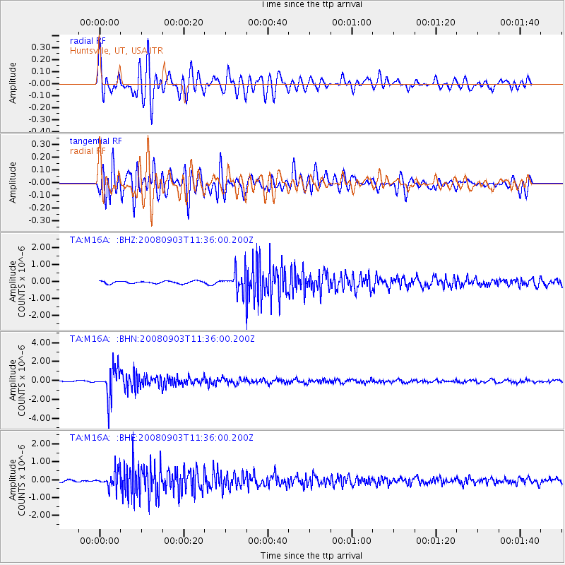
Signal To Noise
| Channel | StoN | STA | LTA |
| TA:M16A: :BHN:20080903T11:36:00.200Z | 22.100176 | 1.5395851E-6 | 6.966393E-8 |
| TA:M16A: :BHE:20080903T11:36:00.200Z | 9.228659 | 4.731684E-7 | 5.127163E-8 |
| TA:M16A: :BHZ:20080903T11:36:00.200Z | 8.567354 | 5.9252665E-7 | 6.916098E-8 |
| Arrivals |
| Ps | 9.6 SECOND |
| PpPs | 27 SECOND |
| PsPs/PpSs | 37 SECOND |


