You are here: Home > Network List > TA - USArray Transportable Network (new EarthScope stations) Stations List
> Station M16A Huntsville, UT, USA > Earthquake Result Viewer
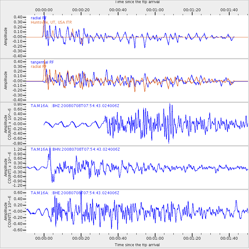
M16A Huntsville, UT, USA - Earthquake Result Viewer
*The percent match for this event was below the threshold and hence no stack was calculated.
| Earthquake location: |
Ryukyu Islands, Japan |
| Earthquake latitude/longitude: |
27.5/128.3 |
| Earthquake time(UTC): |
2008/07/08 (190) 07:42:10 GMT |
| Earthquake Depth: |
43 km |
| Earthquake Magnitude: |
6.0 MB, 5.5 MS, 6.0 MW, 6.0 MW |
| Earthquake Catalog/Contributor: |
WHDF/NEIC |
|
| Network: |
TA USArray Transportable Network (new EarthScope stations) |
| Station: |
M16A Huntsville, UT, USA |
| Lat/Lon: |
41.31 N/111.63 W |
| Elevation: |
1872 m |
|
| Distance: |
91.9 deg |
| Az: |
40.728 deg |
| Baz: |
309.72 deg |
| Ray Param: |
$rayparam |
*The percent match for this event was below the threshold and hence was not used in the summary stack. |
|
| Radial Match: |
79.68416 % |
| Radial Bump: |
400 |
| Transverse Match: |
69.51307 % |
| Transverse Bump: |
400 |
| SOD ConfigId: |
2504 |
| Insert Time: |
2010-03-06 12:03:40.151 +0000 |
| GWidth: |
2.5 |
| Max Bumps: |
400 |
| Tol: |
0.001 |
|
Signal To Noise
| Channel | StoN | STA | LTA |
| TA:M16A: :BHN:20080708T07:54:43.024006Z | 9.707573 | 5.319193E-7 | 5.4794263E-8 |
| TA:M16A: :BHE:20080708T07:54:43.024006Z | 2.3284874 | 1.3827496E-7 | 5.9384025E-8 |
| TA:M16A: :BHZ:20080708T07:54:43.024006Z | 2.632388 | 1.7228126E-7 | 6.5446756E-8 |
| Arrivals |
| Ps | |
| PpPs | |
| PsPs/PpSs | |


