You are here: Home > Network List > TA - USArray Transportable Network (new EarthScope stations) Stations List
> Station MSTX Muleshoe, TX, USA > Earthquake Result Viewer
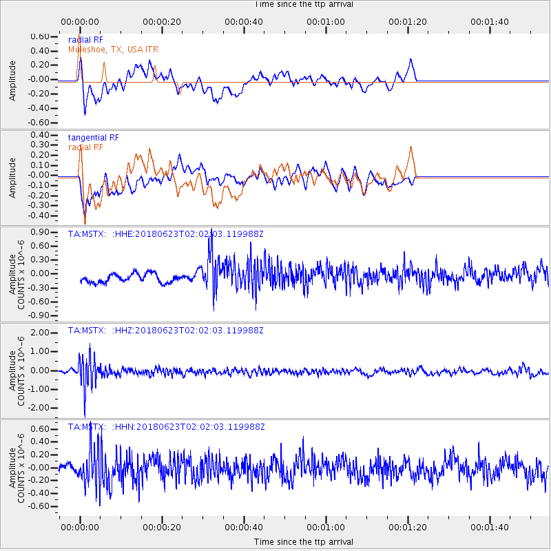
MSTX Muleshoe, TX, USA - Earthquake Result Viewer
*The percent match for this event was below the threshold and hence no stack was calculated.
| Earthquake location: |
Near Coast Of Venezuela |
| Earthquake latitude/longitude: |
10.8/-62.6 |
| Earthquake time(UTC): |
2018/06/23 (174) 01:54:42 GMT |
| Earthquake Depth: |
106 km |
| Earthquake Magnitude: |
5.1 Mww |
| Earthquake Catalog/Contributor: |
NEIC PDE/us |
|
| Network: |
TA USArray Transportable Network (new EarthScope stations) |
| Station: |
MSTX Muleshoe, TX, USA |
| Lat/Lon: |
33.97 N/102.77 W |
| Elevation: |
1167 m |
|
| Distance: |
43.3 deg |
| Az: |
308.659 deg |
| Baz: |
112.587 deg |
| Ray Param: |
$rayparam |
*The percent match for this event was below the threshold and hence was not used in the summary stack. |
|
| Radial Match: |
57.459755 % |
| Radial Bump: |
400 |
| Transverse Match: |
54.9736 % |
| Transverse Bump: |
400 |
| SOD ConfigId: |
13570011 |
| Insert Time: |
2019-04-30 11:03:27.722 +0000 |
| GWidth: |
2.5 |
| Max Bumps: |
400 |
| Tol: |
0.001 |
|
Signal To Noise
| Channel | StoN | STA | LTA |
| TA:MSTX: :HHZ:20180623T02:02:03.119988Z | 9.308256 | 7.685421E-7 | 8.256564E-8 |
| TA:MSTX: :HHN:20180623T02:02:03.119988Z | 3.0885234 | 2.8408635E-7 | 9.1981285E-8 |
| TA:MSTX: :HHE:20180623T02:02:03.119988Z | 4.396345 | 4.0274134E-7 | 9.1608214E-8 |
| Arrivals |
| Ps | |
| PpPs | |
| PsPs/PpSs | |


