You are here: Home > Network List > II - Global Seismograph Network (GSN - IRIS/IDA) Stations List
> Station WRAB Tennant Creek, NT, Australia > Earthquake Result Viewer
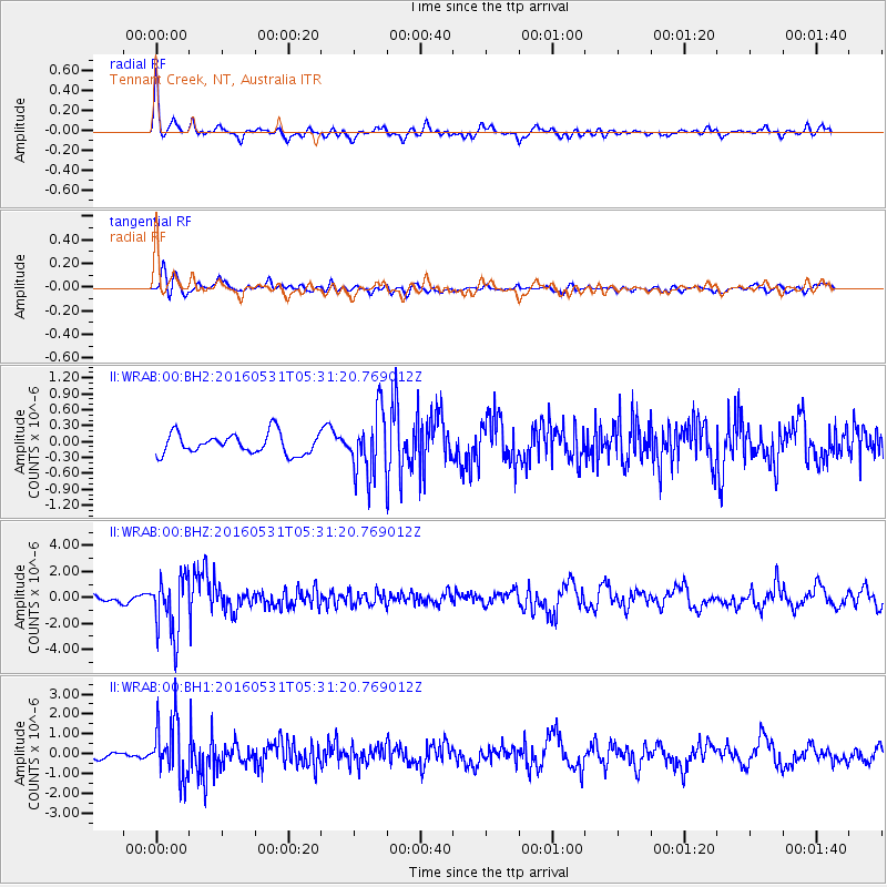
WRAB Tennant Creek, NT, Australia - Earthquake Result Viewer
*The percent match for this event was below the threshold and hence no stack was calculated.
| Earthquake location: |
Taiwan Region |
| Earthquake latitude/longitude: |
25.6/122.5 |
| Earthquake time(UTC): |
2016/05/31 (152) 05:23:47 GMT |
| Earthquake Depth: |
243 km |
| Earthquake Magnitude: |
6.1 MO |
| Earthquake Catalog/Contributor: |
NEIC PDE/NEIC ALERT |
|
| Network: |
II Global Seismograph Network (GSN - IRIS/IDA) |
| Station: |
WRAB Tennant Creek, NT, Australia |
| Lat/Lon: |
19.93 S/134.36 E |
| Elevation: |
366 m |
|
| Distance: |
46.7 deg |
| Az: |
164.607 deg |
| Baz: |
345.237 deg |
| Ray Param: |
$rayparam |
*The percent match for this event was below the threshold and hence was not used in the summary stack. |
|
| Radial Match: |
77.17242 % |
| Radial Bump: |
394 |
| Transverse Match: |
67.75265 % |
| Transverse Bump: |
400 |
| SOD ConfigId: |
1475611 |
| Insert Time: |
2016-06-14 05:25:52.712 +0000 |
| GWidth: |
2.5 |
| Max Bumps: |
400 |
| Tol: |
0.001 |
|
Signal To Noise
| Channel | StoN | STA | LTA |
| II:WRAB:00:BHZ:20160531T05:31:20.769012Z | 7.919401 | 2.2556192E-6 | 2.8482194E-7 |
| II:WRAB:00:BH1:20160531T05:31:20.769012Z | 5.797181 | 1.4433457E-6 | 2.489737E-7 |
| II:WRAB:00:BH2:20160531T05:31:20.769012Z | 3.0064783 | 5.817267E-7 | 1.9349108E-7 |
| Arrivals |
| Ps | |
| PpPs | |
| PsPs/PpSs | |


