H14A Leadore, ID, USA - Earthquake Result Viewer
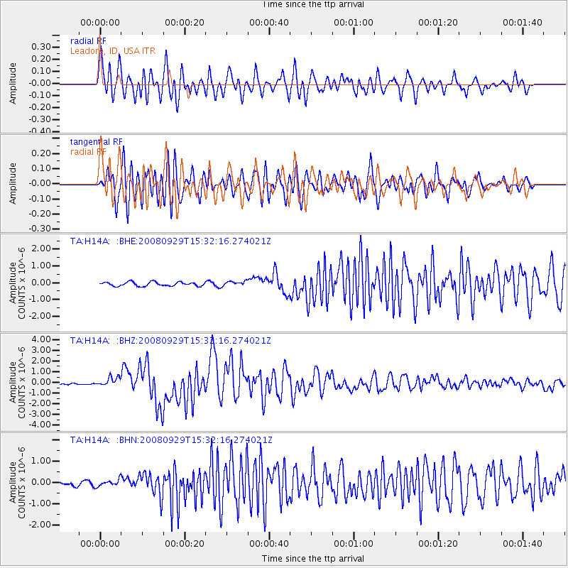
Earthquake location: Kermadec Islands, New Zealand
Earthquake latitude/longitude: -29.8/-177.7
Earthquake time(UTC): 2008/09/29 (273) 15:19:31 GMT
Earthquake Depth: 36 km
Earthquake Magnitude: 6.5 MB, 6.7 MS, 7.0 MW, 7.0 MW
Earthquake Catalog/Contributor: WHDF/NEIC
Network: TA USArray Transportable Network (new EarthScope stations)
Station: H14A Leadore, ID, USA
Lat/Lon: 44.62 N/113.37 W
Elevation: 1933 m
Distance: 94.4 deg
Az: 40.203 deg
Baz: 231.81 deg
Ray Param: 0.041040912
Estimated Moho Depth: 37.75 km
Estimated Crust Vp/Vs: 1.79
Assumed Crust Vp: 6.577 km/s
Estimated Crust Vs: 3.674 km/s
Estimated Crust Poisson's Ratio: 0.27
Radial Match: 90.65164 %
Radial Bump: 400
Transverse Match: 90.697395 %
Transverse Bump: 400
SOD ConfigId: 2560
Insert Time: 2010-03-06 12:05:46.316 +0000
GWidth: 2.5
Max Bumps: 400
Tol: 0.001

Signal To Noise

ChannelStoNSTALTA
TA:H14A: :BHZ:20080929T15:32:16.274021Z5.07864674.2899524E-78.447038E-8
TA:H14A: :BHN:20080929T15:32:16.274021Z1.12433651.5150894E-71.3475409E-7
TA:H14A: :BHE:20080929T15:32:16.274021Z1.13528631.3533925E-71.1921155E-7
Arrivals
Ps4.6 SECOND
PpPs16 SECOND
PsPs/PpSs20 SECOND