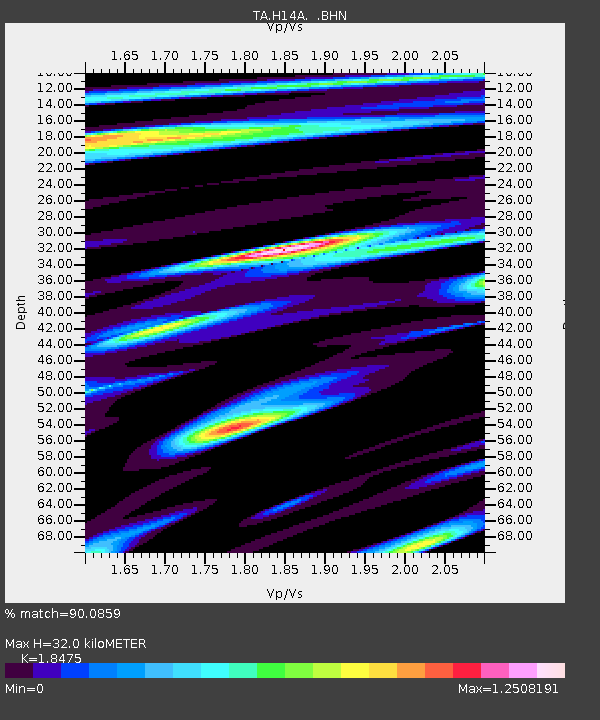
H14A Leadore, ID, USA - Earthquake Result Viewer
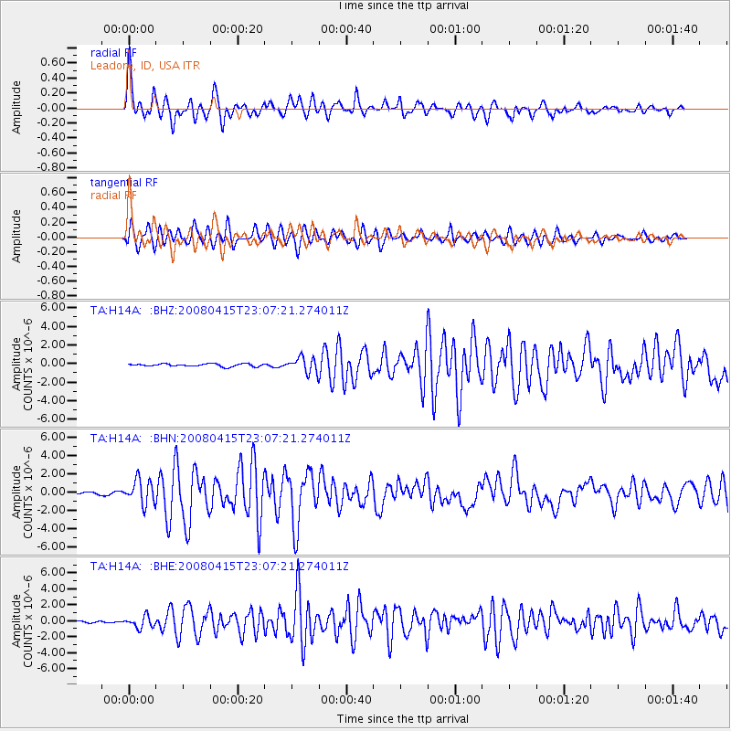
Earthquake location: Andreanof Islands, Aleutian Is.
Earthquake latitude/longitude: 51.9/-179.4
Earthquake time(UTC): 2008/04/15 (106) 22:59:51 GMT
Earthquake Depth: 10 km
Earthquake Magnitude: 6.1 MB, 6.4 MS, 6.4 MW, 6.4 MW
Earthquake Catalog/Contributor: WHDF/NEIC
Network: TA USArray Transportable Network (new EarthScope stations)
Station: H14A Leadore, ID, USA
Lat/Lon: 44.62 N/113.37 W
Elevation: 1933 m
Distance: 43.2 deg
Az: 72.46 deg
Baz: 304.098 deg
Ray Param: 0.07272315
Estimated Moho Depth: 32.0 km
Estimated Crust Vp/Vs: 1.85
Assumed Crust Vp: 6.577 km/s
Estimated Crust Vs: 3.56 km/s
Estimated Crust Poisson's Ratio: 0.29
Radial Match: 90.0859 %
Radial Bump: 386
Transverse Match: 79.103516 %
Transverse Bump: 400
SOD ConfigId: 2504
Insert Time: 2010-03-06 12:06:50.968 +0000
GWidth: 2.5
Max Bumps: 400
Tol: 0.001

Signal To Noise

ChannelStoNSTALTA
TA:H14A: :BHN:20080415T23:07:21.274011Z10.4752491.3370112E-61.2763526E-7
TA:H14A: :BHE:20080415T23:07:21.274011Z6.508047.4106975E-71.1386989E-7
TA:H14A: :BHZ:20080415T23:07:21.274011Z5.8189588.274642E-71.4220144E-7
Arrivals
Ps4.4 SECOND
PpPs13 SECOND
PsPs/PpSs17 SECOND