You are here: Home > Network List > TA - USArray Transportable Network (new EarthScope stations) Stations List
> Station C16K Lisburne Hills, AK, USA > Earthquake Result Viewer
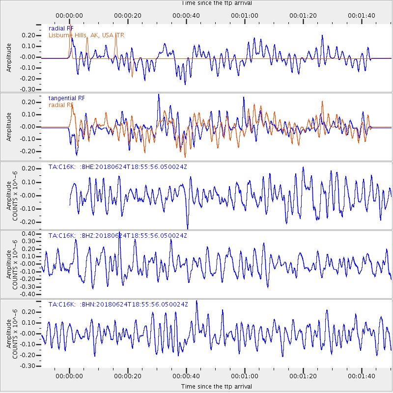
C16K Lisburne Hills, AK, USA - Earthquake Result Viewer
*The percent match for this event was below the threshold and hence no stack was calculated.
| Earthquake location: |
Central East Pacific Rise |
| Earthquake latitude/longitude: |
-9.0/-108.5 |
| Earthquake time(UTC): |
2018/06/24 (175) 18:43:42 GMT |
| Earthquake Depth: |
10 km |
| Earthquake Magnitude: |
5.7 Mww |
| Earthquake Catalog/Contributor: |
NEIC PDE/us |
|
| Network: |
TA USArray Transportable Network (new EarthScope stations) |
| Station: |
C16K Lisburne Hills, AK, USA |
| Lat/Lon: |
68.27 N/165.34 W |
| Elevation: |
102 m |
|
| Distance: |
86.8 deg |
| Az: |
341.817 deg |
| Baz: |
124.118 deg |
| Ray Param: |
$rayparam |
*The percent match for this event was below the threshold and hence was not used in the summary stack. |
|
| Radial Match: |
58.37381 % |
| Radial Bump: |
400 |
| Transverse Match: |
62.10656 % |
| Transverse Bump: |
400 |
| SOD ConfigId: |
13570011 |
| Insert Time: |
2019-04-30 11:15:54.528 +0000 |
| GWidth: |
2.5 |
| Max Bumps: |
400 |
| Tol: |
0.001 |
|
Signal To Noise
| Channel | StoN | STA | LTA |
| TA:C16K: :BHZ:20180624T18:55:56.050024Z | 2.1087475 | 1.6318086E-7 | 7.7382836E-8 |
| TA:C16K: :BHN:20180624T18:55:56.050024Z | 0.7235089 | 4.9389342E-8 | 6.8263624E-8 |
| TA:C16K: :BHE:20180624T18:55:56.050024Z | 0.73120934 | 5.093928E-8 | 6.966443E-8 |
| Arrivals |
| Ps | |
| PpPs | |
| PsPs/PpSs | |


