You are here: Home > Network List > TA - USArray Transportable Network (new EarthScope stations) Stations List
> Station M53A WI Miller and Sons, Farmdale, OH, USA > Earthquake Result Viewer
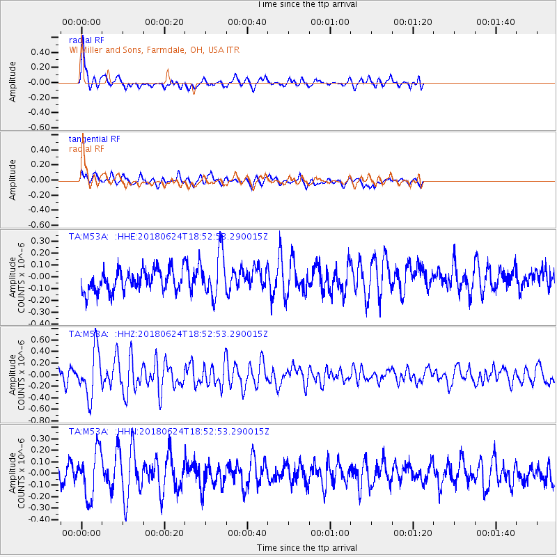
M53A WI Miller and Sons, Farmdale, OH, USA - Earthquake Result Viewer
*The percent match for this event was below the threshold and hence no stack was calculated.
| Earthquake location: |
Central East Pacific Rise |
| Earthquake latitude/longitude: |
-9.0/-108.5 |
| Earthquake time(UTC): |
2018/06/24 (175) 18:43:42 GMT |
| Earthquake Depth: |
10 km |
| Earthquake Magnitude: |
5.7 Mww |
| Earthquake Catalog/Contributor: |
NEIC PDE/us |
|
| Network: |
TA USArray Transportable Network (new EarthScope stations) |
| Station: |
M53A WI Miller and Sons, Farmdale, OH, USA |
| Lat/Lon: |
41.44 N/80.68 W |
| Elevation: |
334 m |
|
| Distance: |
56.4 deg |
| Az: |
24.962 deg |
| Baz: |
213.671 deg |
| Ray Param: |
$rayparam |
*The percent match for this event was below the threshold and hence was not used in the summary stack. |
|
| Radial Match: |
75.4858 % |
| Radial Bump: |
385 |
| Transverse Match: |
56.00061 % |
| Transverse Bump: |
400 |
| SOD ConfigId: |
13570011 |
| Insert Time: |
2019-04-30 11:17:22.175 +0000 |
| GWidth: |
2.5 |
| Max Bumps: |
400 |
| Tol: |
0.001 |
|
Signal To Noise
| Channel | StoN | STA | LTA |
| TA:M53A: :HHZ:20180624T18:52:53.290015Z | 3.612842 | 4.0876856E-7 | 1.1314321E-7 |
| TA:M53A: :HHN:20180624T18:52:53.290015Z | 2.4700062 | 2.0509083E-7 | 8.303252E-8 |
| TA:M53A: :HHE:20180624T18:52:53.290015Z | 2.1714687 | 1.9194293E-7 | 8.8393136E-8 |
| Arrivals |
| Ps | |
| PpPs | |
| PsPs/PpSs | |


