You are here: Home > Network List > TA - USArray Transportable Network (new EarthScope stations) Stations List
> Station H14A Leadore, ID, USA > Earthquake Result Viewer
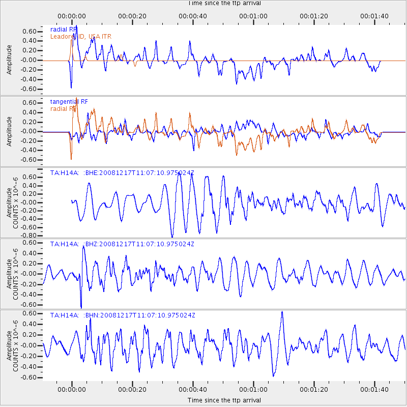
H14A Leadore, ID, USA - Earthquake Result Viewer
*The percent match for this event was below the threshold and hence no stack was calculated.
| Earthquake location: |
Fiji Islands Region |
| Earthquake latitude/longitude: |
-17.7/-178.4 |
| Earthquake time(UTC): |
2008/12/17 (352) 10:55:59 GMT |
| Earthquake Depth: |
530 km |
| Earthquake Magnitude: |
5.8 MW, 5.2 MB, 5.8 MW |
| Earthquake Catalog/Contributor: |
WHDF/NEIC |
|
| Network: |
TA USArray Transportable Network (new EarthScope stations) |
| Station: |
H14A Leadore, ID, USA |
| Lat/Lon: |
44.62 N/113.37 W |
| Elevation: |
1933 m |
|
| Distance: |
85.7 deg |
| Az: |
40.477 deg |
| Baz: |
240.024 deg |
| Ray Param: |
$rayparam |
*The percent match for this event was below the threshold and hence was not used in the summary stack. |
|
| Radial Match: |
54.387386 % |
| Radial Bump: |
400 |
| Transverse Match: |
54.013325 % |
| Transverse Bump: |
400 |
| SOD ConfigId: |
2658 |
| Insert Time: |
2010-03-06 12:08:13.604 +0000 |
| GWidth: |
2.5 |
| Max Bumps: |
400 |
| Tol: |
0.001 |
|
Signal To Noise
| Channel | StoN | STA | LTA |
| TA:H14A: :BHZ:20081217T11:07:10.975024Z | 1.6471287 | 2.6052678E-7 | 1.5817027E-7 |
| TA:H14A: :BHN:20081217T11:07:10.975024Z | 1.1493572 | 2.0575838E-7 | 1.790204E-7 |
| TA:H14A: :BHE:20081217T11:07:10.975024Z | 1.9642314 | 4.1556038E-7 | 2.1156386E-7 |
| Arrivals |
| Ps | |
| PpPs | |
| PsPs/PpSs | |


