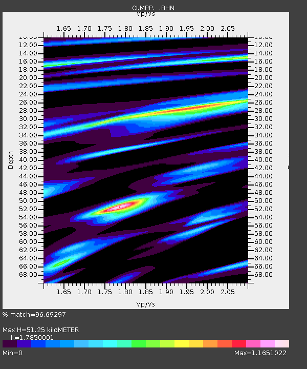
MPP McPhearson Peak - Earthquake Result Viewer
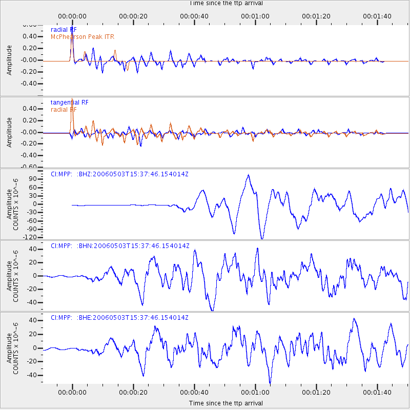
Earthquake location: Tonga Islands
Earthquake latitude/longitude: -20.2/-174.1
Earthquake time(UTC): 2006/05/03 (123) 15:26:40 GMT
Earthquake Depth: 55 km
Earthquake Magnitude: 7.2 MB, 7.8 MS, 7.9 MW, 7.9 MW
Earthquake Catalog/Contributor: WHDF/NEIC
Network: CI Caltech Regional Seismic Network
Station: MPP McPhearson Peak
Lat/Lon: 34.89 N/119.81 W
Elevation: 1739 m
Distance: 75.2 deg
Az: 43.671 deg
Baz: 232.093 deg
Ray Param: 0.051710293
Estimated Moho Depth: 51.25 km
Estimated Crust Vp/Vs: 1.79
Assumed Crust Vp: 6.1 km/s
Estimated Crust Vs: 3.417 km/s
Estimated Crust Poisson's Ratio: 0.27
Radial Match: 96.69297 %
Radial Bump: 398
Transverse Match: 88.21361 %
Transverse Bump: 400
SOD ConfigId: 2669
Insert Time: 2010-02-26 02:02:13.137 +0000
GWidth: 2.5
Max Bumps: 400
Tol: 0.001

Signal To Noise

ChannelStoNSTALTA
CI:MPP: :BHN:20060503T15:37:46.154014Z1.72549088.5902576E-74.978443E-7
CI:MPP: :BHE:20060503T15:37:46.154014Z1.11098581.2964983E-61.1669802E-6
CI:MPP: :BHZ:20060503T15:37:46.154014Z2.8855662.0318594E-67.041458E-7
Arrivals
Ps6.8 SECOND
PpPs23 SECOND
PsPs/PpSs30 SECOND