MPP McPhearson Peak - Earthquake Result Viewer
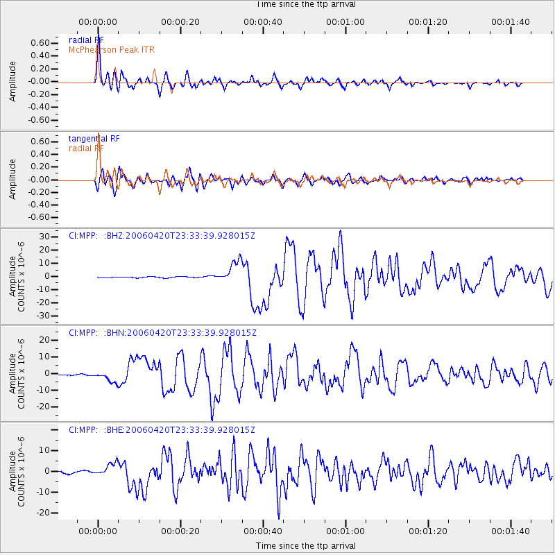
Earthquake location: Eastern Siberia, Russia
Earthquake latitude/longitude: 60.9/167.1
Earthquake time(UTC): 2006/04/20 (110) 23:25:02 GMT
Earthquake Depth: 22 km
Earthquake Magnitude: 6.8 MB, 7.6 MS, 7.6 MW, 7.3 MW
Earthquake Catalog/Contributor: WHDF/NEIC
Network: CI Caltech Regional Seismic Network
Station: MPP McPhearson Peak
Lat/Lon: 34.89 N/119.81 W
Elevation: 1739 m
Distance: 52.1 deg
Az: 84.965 deg
Baz: 323.741 deg
Ray Param: 0.06691507
Estimated Moho Depth: 53.0 km
Estimated Crust Vp/Vs: 1.63
Assumed Crust Vp: 6.1 km/s
Estimated Crust Vs: 3.748 km/s
Estimated Crust Poisson's Ratio: 0.20
Radial Match: 96.21332 %
Radial Bump: 400
Transverse Match: 90.67525 %
Transverse Bump: 400
SOD ConfigId: 2669
Insert Time: 2010-02-26 02:02:17.703 +0000
GWidth: 2.5
Max Bumps: 400
Tol: 0.001

Signal To Noise

ChannelStoNSTALTA
CI:MPP: :BHN:20060420T23:33:39.928015Z9.9394743.4012487E-63.4219605E-7
CI:MPP: :BHE:20060420T23:33:39.928015Z4.9627093.277724E-66.6047073E-7
CI:MPP: :BHZ:20060420T23:33:39.928015Z23.253788.829391E-63.79697E-7
Arrivals
Ps5.8 SECOND
PpPs22 SECOND
PsPs/PpSs27 SECOND