You are here: Home > Network List > TA - USArray Transportable Network (new EarthScope stations) Stations List
> Station H14A Leadore, ID, USA > Earthquake Result Viewer
H14A Leadore, ID, USA - Earthquake Result Viewer
*The percent match for this event was below the threshold and hence no stack was calculated.
| Earthquake location: |
Near Coast Of Guatemala |
| Earthquake latitude/longitude: |
13.6/-91.0 |
| Earthquake time(UTC): |
2008/05/27 (148) 11:27:55 GMT |
| Earthquake Depth: |
26 km |
| Earthquake Magnitude: |
5.7 MW, 5.1 MS, 5.3 MB, 5.6 MW |
| Earthquake Catalog/Contributor: |
WHDF/NEIC |
|
| Network: |
TA USArray Transportable Network (new EarthScope stations) |
| Station: |
H14A Leadore, ID, USA |
| Lat/Lon: |
44.62 N/113.37 W |
| Elevation: |
1933 m |
|
| Distance: |
36.3 deg |
| Az: |
332.696 deg |
| Baz: |
141.357 deg |
| Ray Param: |
$rayparam |
*The percent match for this event was below the threshold and hence was not used in the summary stack. |
|
| Radial Match: |
73.84243 % |
| Radial Bump: |
400 |
| Transverse Match: |
66.05782 % |
| Transverse Bump: |
400 |
| SOD ConfigId: |
2504 |
| Insert Time: |
2010-03-06 12:10:05.413 +0000 |
| GWidth: |
2.5 |
| Max Bumps: |
400 |
| Tol: |
0.001 |
|
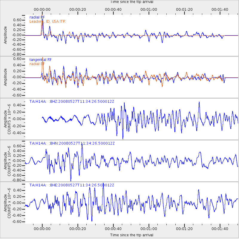
Signal To Noise
| Channel | StoN | STA | LTA |
| TA:H14A: :BHN:20080527T11:34:26.500012Z | 2.2842703 | 2.296739E-7 | 1.0054585E-7 |
| TA:H14A: :BHE:20080527T11:34:26.500012Z | 1.0014955 | 1.3202666E-7 | 1.3182951E-7 |
| TA:H14A: :BHZ:20080527T11:34:26.500012Z | 1.7751657 | 1.0768884E-7 | 6.066411E-8 |
| Arrivals |
| Ps | |
| PpPs | |
| PsPs/PpSs | |


