You are here: Home > Network List > TA - USArray Transportable Network (new EarthScope stations) Stations List
> Station B18K Kokolik River, AK, USA > Earthquake Result Viewer
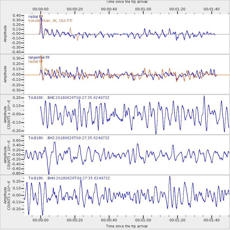
B18K Kokolik River, AK, USA - Earthquake Result Viewer
*The percent match for this event was below the threshold and hence no stack was calculated.
| Earthquake location: |
Galapagos Islands, Ecuador |
| Earthquake latitude/longitude: |
-0.7/-90.9 |
| Earthquake time(UTC): |
2018/06/26 (177) 09:15:36 GMT |
| Earthquake Depth: |
10 km |
| Earthquake Magnitude: |
5.5 Mww |
| Earthquake Catalog/Contributor: |
NEIC PDE/us |
|
| Network: |
TA USArray Transportable Network (new EarthScope stations) |
| Station: |
B18K Kokolik River, AK, USA |
| Lat/Lon: |
69.36 N/161.80 W |
| Elevation: |
222 m |
|
| Distance: |
84.0 deg |
| Az: |
340.319 deg |
| Baz: |
108.207 deg |
| Ray Param: |
$rayparam |
*The percent match for this event was below the threshold and hence was not used in the summary stack. |
|
| Radial Match: |
59.83491 % |
| Radial Bump: |
400 |
| Transverse Match: |
45.1922 % |
| Transverse Bump: |
400 |
| SOD ConfigId: |
13570011 |
| Insert Time: |
2019-04-30 11:40:45.800 +0000 |
| GWidth: |
2.5 |
| Max Bumps: |
400 |
| Tol: |
0.001 |
|
Signal To Noise
| Channel | StoN | STA | LTA |
| TA:B18K: :BHZ:20180626T09:27:35.624973Z | 2.673946 | 2.9314313E-7 | 1.0962942E-7 |
| TA:B18K: :BHN:20180626T09:27:35.624973Z | 1.6111779 | 1.4394796E-7 | 8.934331E-8 |
| TA:B18K: :BHE:20180626T09:27:35.624973Z | 1.0759581 | 9.3119276E-8 | 8.654545E-8 |
| Arrivals |
| Ps | |
| PpPs | |
| PsPs/PpSs | |


