You are here: Home > Network List > TA - USArray Transportable Network (new EarthScope stations) Stations List
> Station M17A Scullys Gap (BLM), Evanston, WY, USA > Earthquake Result Viewer
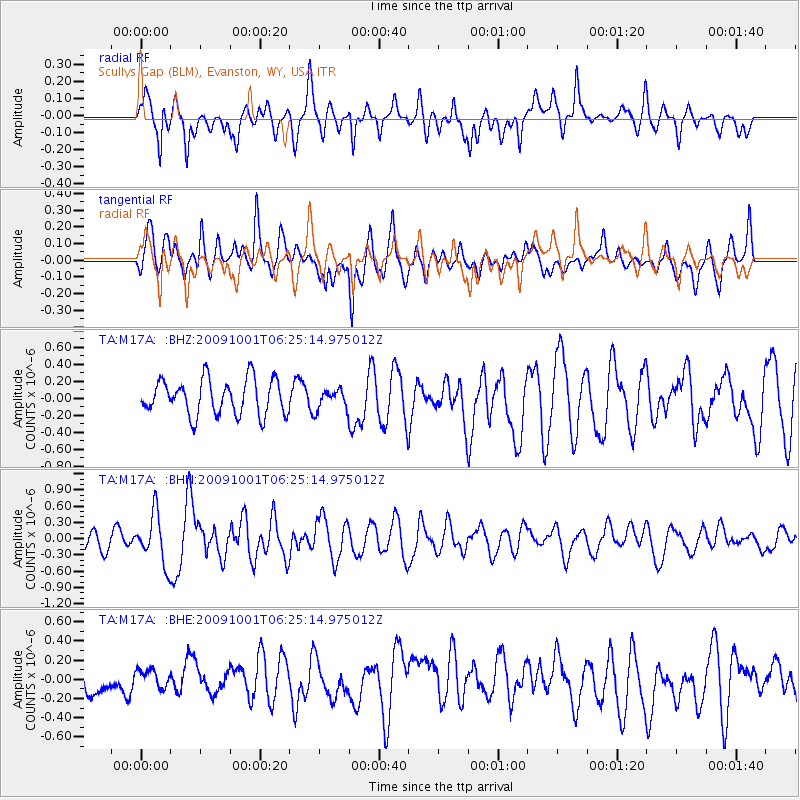
M17A Scullys Gap (BLM), Evanston, WY, USA - Earthquake Result Viewer
*The percent match for this event was below the threshold and hence no stack was calculated.
| Earthquake location: |
Tonga Islands |
| Earthquake latitude/longitude: |
-15.4/-173.3 |
| Earthquake time(UTC): |
2009/10/01 (274) 06:13:32 GMT |
| Earthquake Depth: |
10 km |
| Earthquake Magnitude: |
5.6 MB, 5.7 MS, 5.8 MW, 5.7 MW |
| Earthquake Catalog/Contributor: |
WHDF/NEIC |
|
| Network: |
TA USArray Transportable Network (new EarthScope stations) |
| Station: |
M17A Scullys Gap (BLM), Evanston, WY, USA |
| Lat/Lon: |
41.47 N/110.67 W |
| Elevation: |
2101 m |
|
| Distance: |
80.8 deg |
| Az: |
42.513 deg |
| Baz: |
240.161 deg |
| Ray Param: |
$rayparam |
*The percent match for this event was below the threshold and hence was not used in the summary stack. |
|
| Radial Match: |
67.97286 % |
| Radial Bump: |
400 |
| Transverse Match: |
71.54804 % |
| Transverse Bump: |
400 |
| SOD ConfigId: |
2622 |
| Insert Time: |
2010-03-06 12:12:04.862 +0000 |
| GWidth: |
2.5 |
| Max Bumps: |
400 |
| Tol: |
0.001 |
|
Signal To Noise
| Channel | StoN | STA | LTA |
| TA:M17A: :BHN:20091001T06:25:14.975012Z | 2.5012305 | 4.5557002E-7 | 1.8213836E-7 |
| TA:M17A: :BHE:20091001T06:25:14.975012Z | 0.72543186 | 1.1326804E-7 | 1.5613878E-7 |
| TA:M17A: :BHZ:20091001T06:25:14.975012Z | 0.5771988 | 1.2008816E-7 | 2.0805336E-7 |
| Arrivals |
| Ps | |
| PpPs | |
| PsPs/PpSs | |


