You are here: Home > Network List > TA - USArray Transportable Network (new EarthScope stations) Stations List
> Station J26L Joseph Creek, AK, USA > Earthquake Result Viewer
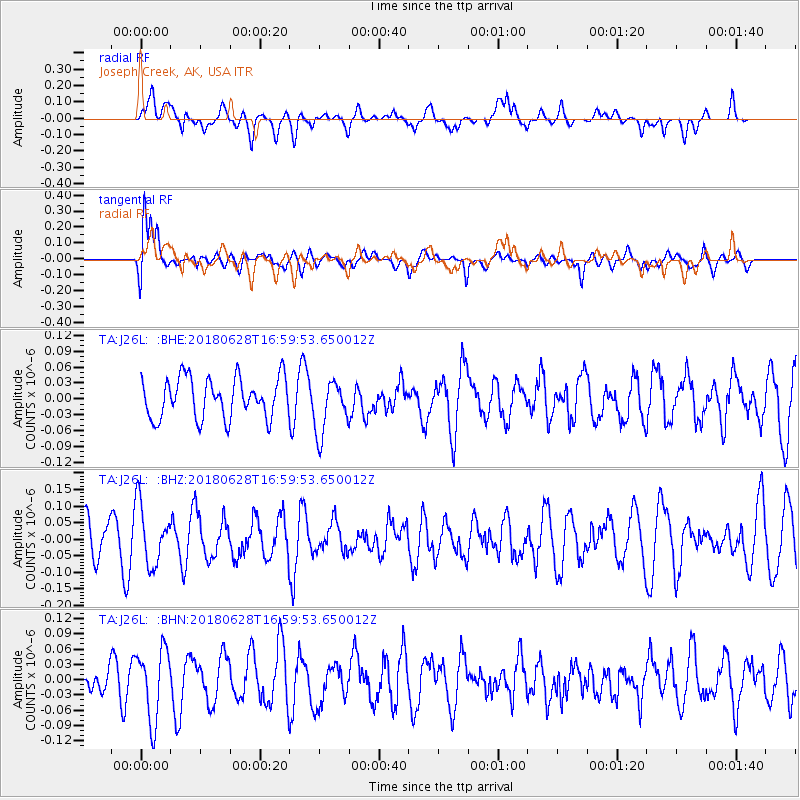
J26L Joseph Creek, AK, USA - Earthquake Result Viewer
*The percent match for this event was below the threshold and hence no stack was calculated.
| Earthquake location: |
Vanuatu Islands |
| Earthquake latitude/longitude: |
-15.1/167.5 |
| Earthquake time(UTC): |
2018/06/28 (179) 16:47:49 GMT |
| Earthquake Depth: |
115 km |
| Earthquake Magnitude: |
5.4 Mww |
| Earthquake Catalog/Contributor: |
NEIC PDE/us |
|
| Network: |
TA USArray Transportable Network (new EarthScope stations) |
| Station: |
J26L Joseph Creek, AK, USA |
| Lat/Lon: |
64.50 N/143.56 W |
| Elevation: |
1144 m |
|
| Distance: |
87.7 deg |
| Az: |
19.073 deg |
| Baz: |
226.81 deg |
| Ray Param: |
$rayparam |
*The percent match for this event was below the threshold and hence was not used in the summary stack. |
|
| Radial Match: |
48.455948 % |
| Radial Bump: |
400 |
| Transverse Match: |
53.29987 % |
| Transverse Bump: |
400 |
| SOD ConfigId: |
13570011 |
| Insert Time: |
2019-04-30 11:48:47.447 +0000 |
| GWidth: |
2.5 |
| Max Bumps: |
400 |
| Tol: |
0.001 |
|
Signal To Noise
| Channel | StoN | STA | LTA |
| TA:J26L: :BHZ:20180628T16:59:53.650012Z | 2.0217626 | 9.024592E-8 | 4.4637247E-8 |
| TA:J26L: :BHN:20180628T16:59:53.650012Z | 2.6151893 | 6.9493765E-8 | 2.657313E-8 |
| TA:J26L: :BHE:20180628T16:59:53.650012Z | 1.3503207 | 5.1315464E-8 | 3.800243E-8 |
| Arrivals |
| Ps | |
| PpPs | |
| PsPs/PpSs | |


