MPP McPhearson Peak - Earthquake Result Viewer
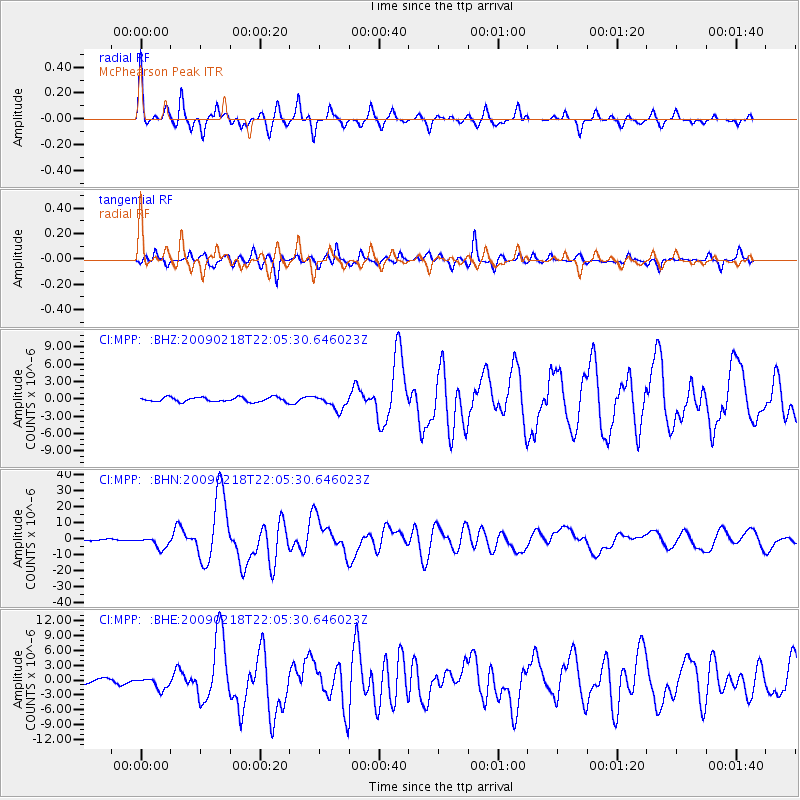
Earthquake location: Kermadec Islands Region
Earthquake latitude/longitude: -27.4/-176.3
Earthquake time(UTC): 2009/02/18 (049) 21:53:45 GMT
Earthquake Depth: 25 km
Earthquake Magnitude: 6.8 MB, 7.2 MS, 6.9 MW, 6.9 MW
Earthquake Catalog/Contributor: WHDF/NEIC
Network: CI Caltech Regional Seismic Network
Station: MPP McPhearson Peak
Lat/Lon: 34.89 N/119.81 W
Elevation: 1739 m
Distance: 81.8 deg
Az: 43.843 deg
Baz: 228.503 deg
Ray Param: 0.047289386
Estimated Moho Depth: 27.25 km
Estimated Crust Vp/Vs: 1.93
Assumed Crust Vp: 6.1 km/s
Estimated Crust Vs: 3.165 km/s
Estimated Crust Poisson's Ratio: 0.32
Radial Match: 94.90721 %
Radial Bump: 336
Transverse Match: 87.02625 %
Transverse Bump: 400
SOD ConfigId: 2658
Insert Time: 2010-02-26 02:02:29.060 +0000
GWidth: 2.5
Max Bumps: 400
Tol: 0.001

Signal To Noise

ChannelStoNSTALTA
CI:MPP: :BHN:20090218T22:05:30.646023Z10.2940653.6388751E-63.5349254E-7
CI:MPP: :BHE:20090218T22:05:30.646023Z3.11921621.1993192E-63.8449377E-7
CI:MPP: :BHZ:20090218T22:05:30.646023Z3.24038651.2598902E-63.888086E-7
Arrivals
Ps4.2 SECOND
PpPs13 SECOND
PsPs/PpSs17 SECOND