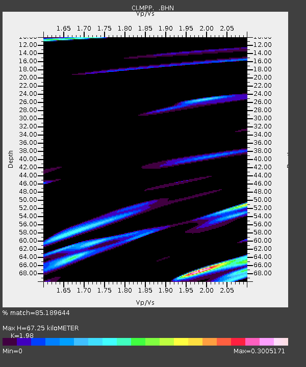
MPP McPhearson Peak - Earthquake Result Viewer
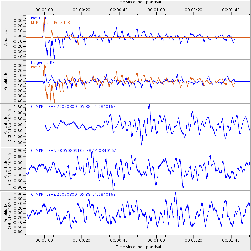
Earthquake location: Vanuatu Islands Region
Earthquake latitude/longitude: -20.9/173.8
Earthquake time(UTC): 2005/08/09 (221) 05:26:17 GMT
Earthquake Depth: 24 km
Earthquake Magnitude: 5.5 MB, 6.0 MS, 6.1 MW, 6.1 MW
Earthquake Catalog/Contributor: WHDF/NEIC
Network: CI Caltech Regional Seismic Network
Station: MPP McPhearson Peak
Lat/Lon: 34.89 N/119.81 W
Elevation: 1739 m
Distance: 83.9 deg
Az: 49.23 deg
Baz: 239.445 deg
Ray Param: 0.045814287
Estimated Moho Depth: 67.25 km
Estimated Crust Vp/Vs: 1.98
Assumed Crust Vp: 6.1 km/s
Estimated Crust Vs: 3.081 km/s
Estimated Crust Poisson's Ratio: 0.33
Radial Match: 85.189644 %
Radial Bump: 400
Transverse Match: 78.41286 %
Transverse Bump: 400
SOD ConfigId: 2422
Insert Time: 2010-02-26 02:02:33.951 +0000
GWidth: 2.5
Max Bumps: 400
Tol: 0.001

Signal To Noise

ChannelStoNSTALTA
CI:MPP: :BHN:20050809T05:38:14.084016Z0.8223131.3365666E-71.6253743E-7
CI:MPP: :BHE:20050809T05:38:14.084016Z1.72875812.842837E-71.6444388E-7
CI:MPP: :BHZ:20050809T05:38:14.084016Z1.22643712.5633867E-72.0901086E-7
Arrivals
Ps11 SECOND
PpPs32 SECOND
PsPs/PpSs43 SECOND