
MPP McPhearson Peak - Earthquake Result Viewer
| ||||||||||||||||||
| ||||||||||||||||||
| ||||||||||||||||||
|
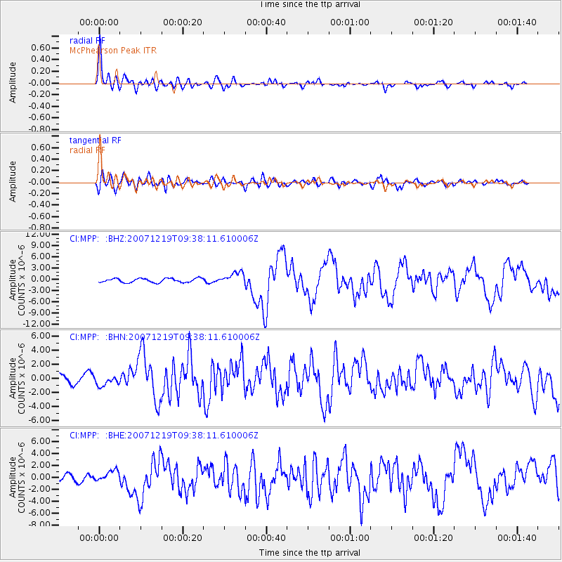
Signal To Noise
| Channel | StoN | STA | LTA |
| CI:MPP: :BHN:20071219T09:38:11.610006Z | 0.9683883 | 7.385072E-7 | 7.626147E-7 |
| CI:MPP: :BHE:20071219T09:38:11.610006Z | 1.5846193 | 9.98448E-7 | 6.30087E-7 |
| CI:MPP: :BHZ:20071219T09:38:11.610006Z | 3.1016805 | 1.6598913E-6 | 5.3515873E-7 |
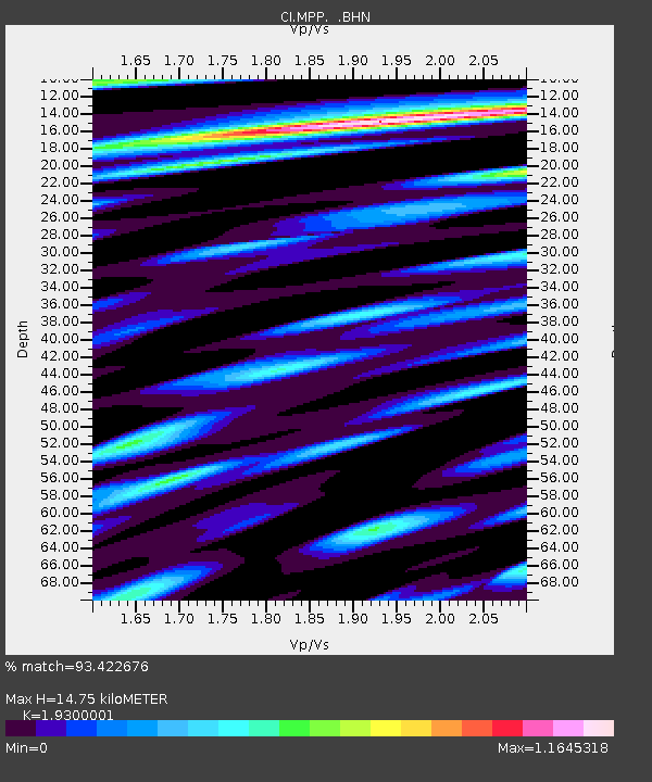
| Arrivals | |
| Ps | 2.4 SECOND |
| PpPs | 6.7 SECOND |
| PsPs/PpSs | 9.1 SECOND |

