You are here: Home > Network List > US - United States National Seismic Network Stations List
> Station HAWA Hanford, Washington, USA > Earthquake Result Viewer
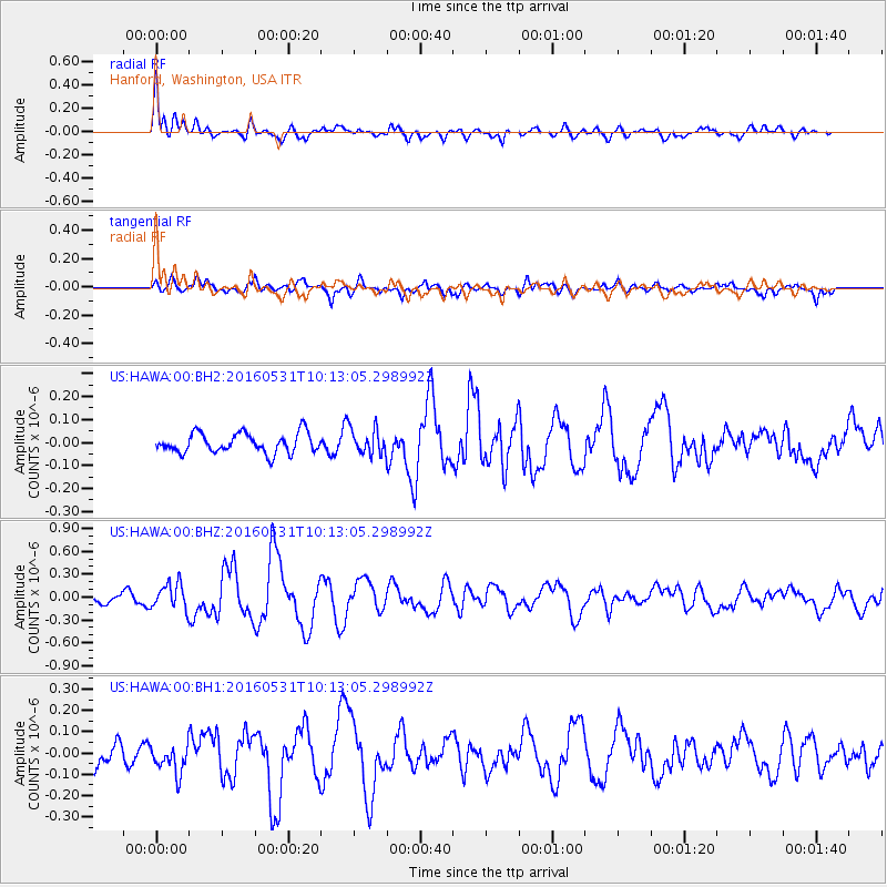
HAWA Hanford, Washington, USA - Earthquake Result Viewer
*The percent match for this event was below the threshold and hence no stack was calculated.
| Earthquake location: |
Kuril Islands |
| Earthquake latitude/longitude: |
47.5/154.4 |
| Earthquake time(UTC): |
2016/05/31 (152) 10:03:59 GMT |
| Earthquake Depth: |
10 km |
| Earthquake Magnitude: |
5.5 MB |
| Earthquake Catalog/Contributor: |
NEIC PDE/NEIC COMCAT |
|
| Network: |
US United States National Seismic Network |
| Station: |
HAWA Hanford, Washington, USA |
| Lat/Lon: |
46.39 N/119.53 W |
| Elevation: |
364 m |
|
| Distance: |
55.8 deg |
| Az: |
56.657 deg |
| Baz: |
305.152 deg |
| Ray Param: |
$rayparam |
*The percent match for this event was below the threshold and hence was not used in the summary stack. |
|
| Radial Match: |
72.07389 % |
| Radial Bump: |
400 |
| Transverse Match: |
74.81618 % |
| Transverse Bump: |
400 |
| SOD ConfigId: |
1475611 |
| Insert Time: |
2016-06-14 10:14:15.439 +0000 |
| GWidth: |
2.5 |
| Max Bumps: |
400 |
| Tol: |
0.001 |
|
Signal To Noise
| Channel | StoN | STA | LTA |
| US:HAWA:00:BHZ:20160531T10:13:05.298992Z | 2.1068852 | 1.6777227E-7 | 7.9630475E-8 |
| US:HAWA:00:BH1:20160531T10:13:05.298992Z | 1.0056579 | 6.743351E-8 | 6.705413E-8 |
| US:HAWA:00:BH2:20160531T10:13:05.298992Z | 1.3036953 | 5.5651547E-8 | 4.268754E-8 |
| Arrivals |
| Ps | |
| PpPs | |
| PsPs/PpSs | |


