MPP McPhearson Peak - Earthquake Result Viewer
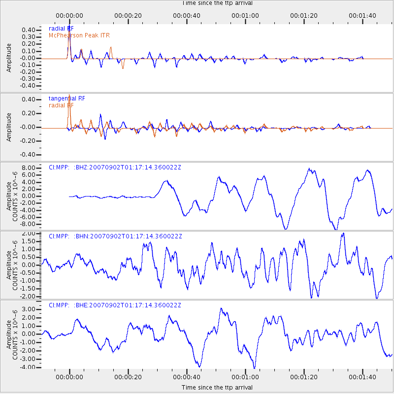
Earthquake location: Santa Cruz Islands
Earthquake latitude/longitude: -11.6/165.8
Earthquake time(UTC): 2007/09/02 (245) 01:05:18 GMT
Earthquake Depth: 35 km
Earthquake Magnitude: 5.9 MB, 7.3 MS, 7.2 MW, 6.9 ME
Earthquake Catalog/Contributor: WHDF/NEIC
Network: CI Caltech Regional Seismic Network
Station: MPP McPhearson Peak
Lat/Lon: 34.89 N/119.81 W
Elevation: 1739 m
Distance: 84.1 deg
Az: 52.756 deg
Baz: 251.589 deg
Ray Param: 0.04565874
Estimated Moho Depth: 28.5 km
Estimated Crust Vp/Vs: 1.84
Assumed Crust Vp: 6.1 km/s
Estimated Crust Vs: 3.32 km/s
Estimated Crust Poisson's Ratio: 0.29
Radial Match: 93.14505 %
Radial Bump: 389
Transverse Match: 85.67645 %
Transverse Bump: 400
SOD ConfigId: 2564
Insert Time: 2010-02-26 02:02:48.055 +0000
GWidth: 2.5
Max Bumps: 400
Tol: 0.001

Signal To Noise

ChannelStoNSTALTA
CI:MPP: :BHN:20070902T01:17:14.360022Z1.83856574.5313965E-72.4646366E-7
CI:MPP: :BHE:20070902T01:17:14.360022Z4.7337171.149101E-62.4274811E-7
CI:MPP: :BHZ:20070902T01:17:14.360022Z19.2579613.1471004E-61.6341815E-7
Arrivals
Ps4.0 SECOND
PpPs13 SECOND
PsPs/PpSs17 SECOND