You are here: Home > Network List > CI - Caltech Regional Seismic Network Stations List
> Station MPM Manuel Prospect Mine, California, USA > Earthquake Result Viewer
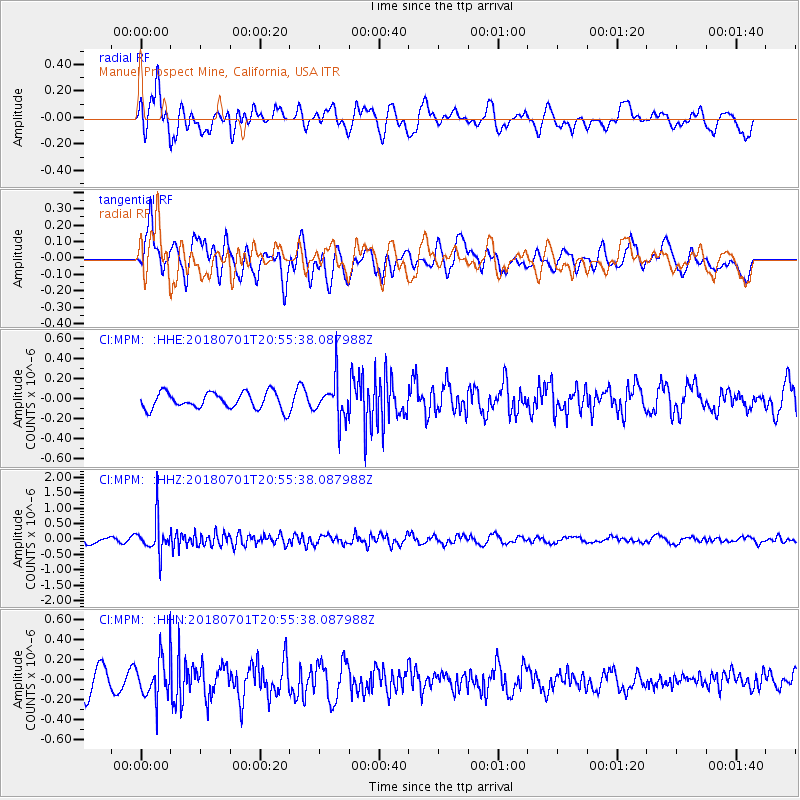
MPM Manuel Prospect Mine, California, USA - Earthquake Result Viewer
*The percent match for this event was below the threshold and hence no stack was calculated.
| Earthquake location: |
Sea Of Okhotsk |
| Earthquake latitude/longitude: |
46.9/145.0 |
| Earthquake time(UTC): |
2018/07/01 (182) 20:45:42 GMT |
| Earthquake Depth: |
388 km |
| Earthquake Magnitude: |
5.6 Mww |
| Earthquake Catalog/Contributor: |
NEIC PDE/us |
|
| Network: |
CI Caltech Regional Seismic Network |
| Station: |
MPM Manuel Prospect Mine, California, USA |
| Lat/Lon: |
36.06 N/117.49 W |
| Elevation: |
185 m |
|
| Distance: |
69.3 deg |
| Az: |
59.206 deg |
| Baz: |
313.403 deg |
| Ray Param: |
$rayparam |
*The percent match for this event was below the threshold and hence was not used in the summary stack. |
|
| Radial Match: |
47.387486 % |
| Radial Bump: |
400 |
| Transverse Match: |
65.50733 % |
| Transverse Bump: |
400 |
| SOD ConfigId: |
13570011 |
| Insert Time: |
2019-04-30 12:04:08.427 +0000 |
| GWidth: |
2.5 |
| Max Bumps: |
400 |
| Tol: |
0.001 |
|
Signal To Noise
| Channel | StoN | STA | LTA |
| CI:MPM: :HHZ:20180701T20:55:38.087988Z | 6.1884246 | 5.359208E-7 | 8.6600515E-8 |
| CI:MPM: :HHN:20180701T20:55:38.087988Z | 2.0512938 | 1.9906885E-7 | 9.704551E-8 |
| CI:MPM: :HHE:20180701T20:55:38.087988Z | 2.4701953 | 2.0296807E-7 | 8.216681E-8 |
| Arrivals |
| Ps | |
| PpPs | |
| PsPs/PpSs | |


