You are here: Home > Network List > CN - Canadian National Seismograph Network Stations List
> Station INK INUVIK, NT > Earthquake Result Viewer
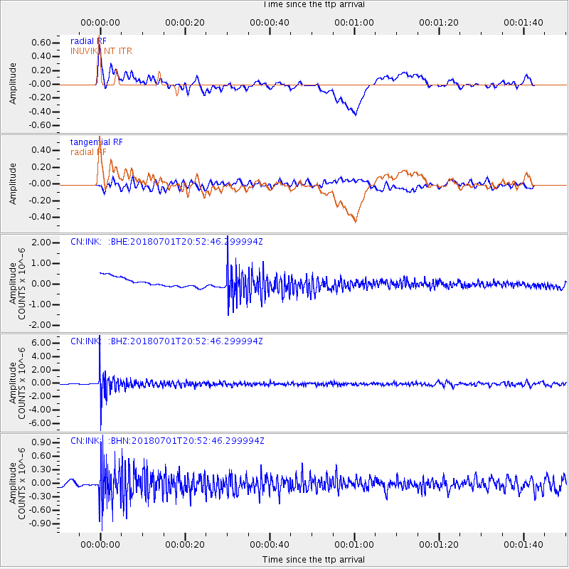
INK INUVIK, NT - Earthquake Result Viewer
*The percent match for this event was below the threshold and hence no stack was calculated.
| Earthquake location: |
Sea Of Okhotsk |
| Earthquake latitude/longitude: |
46.9/145.0 |
| Earthquake time(UTC): |
2018/07/01 (182) 20:45:42 GMT |
| Earthquake Depth: |
388 km |
| Earthquake Magnitude: |
5.6 Mww |
| Earthquake Catalog/Contributor: |
NEIC PDE/us |
|
| Network: |
CN Canadian National Seismograph Network |
| Station: |
INK INUVIK, NT |
| Lat/Lon: |
68.31 N/133.53 W |
| Elevation: |
44 m |
|
| Distance: |
44.5 deg |
| Az: |
31.668 deg |
| Baz: |
284.592 deg |
| Ray Param: |
$rayparam |
*The percent match for this event was below the threshold and hence was not used in the summary stack. |
|
| Radial Match: |
43.42597 % |
| Radial Bump: |
400 |
| Transverse Match: |
52.285793 % |
| Transverse Bump: |
400 |
| SOD ConfigId: |
13570011 |
| Insert Time: |
2019-04-30 12:04:48.191 +0000 |
| GWidth: |
2.5 |
| Max Bumps: |
400 |
| Tol: |
0.001 |
|
Signal To Noise
| Channel | StoN | STA | LTA |
| CN:INK: :BHZ:20180701T20:52:46.299994Z | 33.052563 | 1.8440581E-6 | 5.5791688E-8 |
| CN:INK: :BHN:20180701T20:52:46.299994Z | 8.251124 | 4.0685174E-7 | 4.930864E-8 |
| CN:INK: :BHE:20180701T20:52:46.299994Z | 3.2961085 | 7.411637E-7 | 2.2486023E-7 |
| Arrivals |
| Ps | |
| PpPs | |
| PsPs/PpSs | |


