You are here: Home > Network List > TA - USArray Transportable Network (new EarthScope stations) Stations List
> Station 114A Black Gap (USAF), Gila Bend, AZ, USA > Earthquake Result Viewer
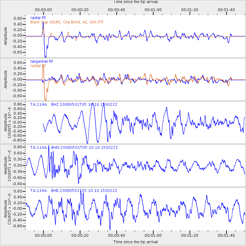
114A Black Gap (USAF), Gila Bend, AZ, USA - Earthquake Result Viewer
*The percent match for this event was below the threshold and hence no stack was calculated.
| Earthquake location: |
Vanuatu Islands |
| Earthquake latitude/longitude: |
-19.5/168.9 |
| Earthquake time(UTC): |
2008/05/01 (122) 04:57:50 GMT |
| Earthquake Depth: |
35 km |
| Earthquake Magnitude: |
5.7 MB, 5.2 MS, 5.7 MW, 5.7 MW |
| Earthquake Catalog/Contributor: |
WHDF/NEIC |
|
| Network: |
TA USArray Transportable Network (new EarthScope stations) |
| Station: |
114A Black Gap (USAF), Gila Bend, AZ, USA |
| Lat/Lon: |
32.75 N/112.88 W |
| Elevation: |
279 m |
|
| Distance: |
90.9 deg |
| Az: |
55.598 deg |
| Baz: |
247.492 deg |
| Ray Param: |
$rayparam |
*The percent match for this event was below the threshold and hence was not used in the summary stack. |
|
| Radial Match: |
75.95711 % |
| Radial Bump: |
400 |
| Transverse Match: |
67.807434 % |
| Transverse Bump: |
400 |
| SOD ConfigId: |
2504 |
| Insert Time: |
2010-03-06 12:16:54.209 +0000 |
| GWidth: |
2.5 |
| Max Bumps: |
400 |
| Tol: |
0.001 |
|
Signal To Noise
| Channel | StoN | STA | LTA |
| TA:114A: :BHN:20080501T05:10:19.150022Z | 2.7336707 | 4.324862E-7 | 1.5820713E-7 |
| TA:114A: :BHE:20080501T05:10:19.150022Z | 1.5056065 | 2.4979389E-7 | 1.6590913E-7 |
| TA:114A: :BHZ:20080501T05:10:19.150022Z | 1.8536891 | 5.686331E-7 | 3.0675753E-7 |
| Arrivals |
| Ps | |
| PpPs | |
| PsPs/PpSs | |


