
MPP McPhearson Peak - Earthquake Result Viewer
| ||||||||||||||||||
| ||||||||||||||||||
| ||||||||||||||||||
|
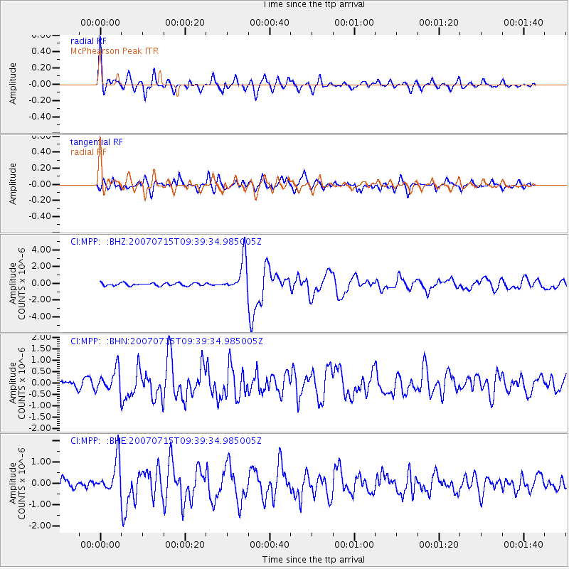
Signal To Noise
| Channel | StoN | STA | LTA |
| CI:MPP: :BHN:20070715T09:39:34.985005Z | 3.0714104 | 4.952912E-7 | 1.6125855E-7 |
| CI:MPP: :BHE:20070715T09:39:34.985005Z | 4.330036 | 7.973532E-7 | 1.841447E-7 |
| CI:MPP: :BHZ:20070715T09:39:34.985005Z | 12.752479 | 1.9999975E-6 | 1.5683204E-7 |
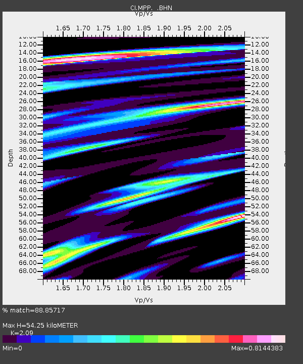
| Arrivals | |
| Ps | 9.9 SECOND |
| PpPs | 27 SECOND |
| PsPs/PpSs | 37 SECOND |

