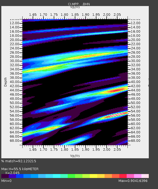
MPP McPhearson Peak - Earthquake Result Viewer
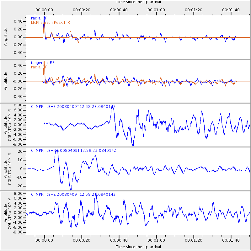
Earthquake location: Loyalty Islands
Earthquake latitude/longitude: -20.1/168.9
Earthquake time(UTC): 2008/04/09 (100) 12:46:12 GMT
Earthquake Depth: 33 km
Earthquake Magnitude: 6.3 MB, 7.3 MS, 7.3 MW, 7.3 MW
Earthquake Catalog/Contributor: WHDF/NEIC
Network: CI Caltech Regional Seismic Network
Station: MPP McPhearson Peak
Lat/Lon: 34.89 N/119.81 W
Elevation: 1739 m
Distance: 86.9 deg
Az: 51.239 deg
Baz: 243.079 deg
Ray Param: 0.043650344
Estimated Moho Depth: 55.5 km
Estimated Crust Vp/Vs: 2.05
Assumed Crust Vp: 6.1 km/s
Estimated Crust Vs: 2.983 km/s
Estimated Crust Poisson's Ratio: 0.34
Radial Match: 92.123215 %
Radial Bump: 364
Transverse Match: 90.540184 %
Transverse Bump: 400
SOD ConfigId: 2504
Insert Time: 2010-02-26 02:03:01.809 +0000
GWidth: 2.5
Max Bumps: 400
Tol: 0.001

Signal To Noise

ChannelStoNSTALTA
CI:MPP: :BHN:20080409T12:58:23.084014Z2.12379261.2893514E-66.070985E-7
CI:MPP: :BHE:20080409T12:58:23.084014Z0.83443714.797873E-75.749832E-7
CI:MPP: :BHZ:20080409T12:58:23.084014Z1.12295348.672342E-77.7227975E-7
Arrivals
Ps9.7 SECOND
PpPs27 SECOND
PsPs/PpSs37 SECOND