You are here: Home > Network List > TA - USArray Transportable Network (new EarthScope stations) Stations List
> Station C16K Lisburne Hills, AK, USA > Earthquake Result Viewer
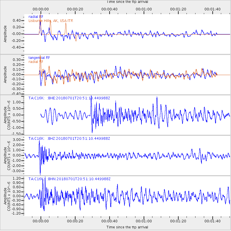
C16K Lisburne Hills, AK, USA - Earthquake Result Viewer
*The percent match for this event was below the threshold and hence no stack was calculated.
| Earthquake location: |
Sea Of Okhotsk |
| Earthquake latitude/longitude: |
46.9/145.0 |
| Earthquake time(UTC): |
2018/07/01 (182) 20:45:42 GMT |
| Earthquake Depth: |
388 km |
| Earthquake Magnitude: |
5.6 Mww |
| Earthquake Catalog/Contributor: |
NEIC PDE/us |
|
| Network: |
TA USArray Transportable Network (new EarthScope stations) |
| Station: |
C16K Lisburne Hills, AK, USA |
| Lat/Lon: |
68.27 N/165.34 W |
| Elevation: |
102 m |
|
| Distance: |
32.7 deg |
| Az: |
31.639 deg |
| Baz: |
254.932 deg |
| Ray Param: |
$rayparam |
*The percent match for this event was below the threshold and hence was not used in the summary stack. |
|
| Radial Match: |
47.703915 % |
| Radial Bump: |
400 |
| Transverse Match: |
58.354073 % |
| Transverse Bump: |
400 |
| SOD ConfigId: |
13570011 |
| Insert Time: |
2019-04-30 12:11:55.224 +0000 |
| GWidth: |
2.5 |
| Max Bumps: |
400 |
| Tol: |
0.001 |
|
Signal To Noise
| Channel | StoN | STA | LTA |
| TA:C16K: :BHZ:20180701T20:51:10.449988Z | 6.5001497 | 1.4404383E-6 | 2.2160079E-7 |
| TA:C16K: :BHN:20180701T20:51:10.449988Z | 2.3879044 | 5.375117E-7 | 2.2509765E-7 |
| TA:C16K: :BHE:20180701T20:51:10.449988Z | 2.5004919 | 6.870484E-7 | 2.7476528E-7 |
| Arrivals |
| Ps | |
| PpPs | |
| PsPs/PpSs | |


