You are here: Home > Network List > TA - USArray Transportable Network (new EarthScope stations) Stations List
> Station F21K Alatna River, AK, USA > Earthquake Result Viewer
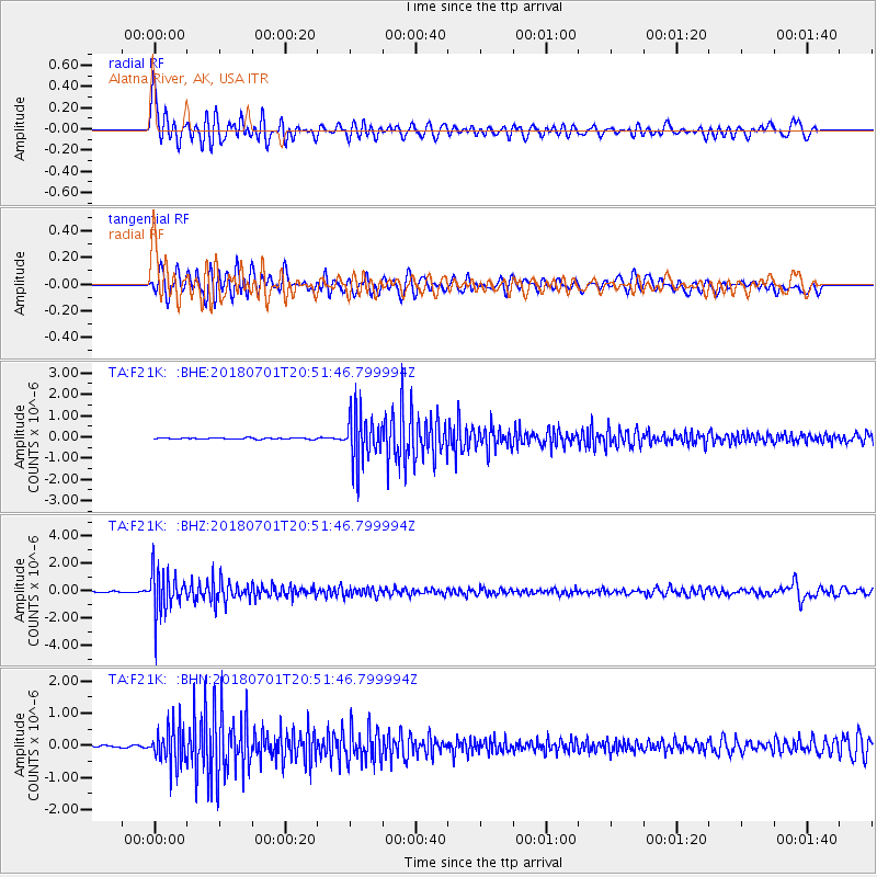
F21K Alatna River, AK, USA - Earthquake Result Viewer
*The percent match for this event was below the threshold and hence no stack was calculated.
| Earthquake location: |
Sea Of Okhotsk |
| Earthquake latitude/longitude: |
46.9/145.0 |
| Earthquake time(UTC): |
2018/07/01 (182) 20:45:42 GMT |
| Earthquake Depth: |
388 km |
| Earthquake Magnitude: |
5.6 Mww |
| Earthquake Catalog/Contributor: |
NEIC PDE/us |
|
| Network: |
TA USArray Transportable Network (new EarthScope stations) |
| Station: |
F21K Alatna River, AK, USA |
| Lat/Lon: |
67.22 N/153.48 W |
| Elevation: |
597 m |
|
| Distance: |
37.1 deg |
| Az: |
34.605 deg |
| Baz: |
268.339 deg |
| Ray Param: |
$rayparam |
*The percent match for this event was below the threshold and hence was not used in the summary stack. |
|
| Radial Match: |
61.629974 % |
| Radial Bump: |
400 |
| Transverse Match: |
59.86597 % |
| Transverse Bump: |
400 |
| SOD ConfigId: |
13570011 |
| Insert Time: |
2019-04-30 12:12:22.142 +0000 |
| GWidth: |
2.5 |
| Max Bumps: |
400 |
| Tol: |
0.001 |
|
Signal To Noise
| Channel | StoN | STA | LTA |
| TA:F21K: :BHZ:20180701T20:51:46.799994Z | 24.36228 | 1.5865356E-6 | 6.512263E-8 |
| TA:F21K: :BHN:20180701T20:51:46.799994Z | 17.454405 | 5.8744587E-7 | 3.3656026E-8 |
| TA:F21K: :BHE:20180701T20:51:46.799994Z | 41.3549 | 1.1514946E-6 | 2.7844212E-8 |
| Arrivals |
| Ps | |
| PpPs | |
| PsPs/PpSs | |


