You are here: Home > Network List > TA - USArray Transportable Network (new EarthScope stations) Stations List
> Station R33M Jennings River, BC, CAN > Earthquake Result Viewer
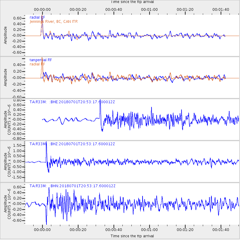
R33M Jennings River, BC, CAN - Earthquake Result Viewer
*The percent match for this event was below the threshold and hence no stack was calculated.
| Earthquake location: |
Sea Of Okhotsk |
| Earthquake latitude/longitude: |
46.9/145.0 |
| Earthquake time(UTC): |
2018/07/01 (182) 20:45:42 GMT |
| Earthquake Depth: |
388 km |
| Earthquake Magnitude: |
5.6 Mww |
| Earthquake Catalog/Contributor: |
NEIC PDE/us |
|
| Network: |
TA USArray Transportable Network (new EarthScope stations) |
| Station: |
R33M Jennings River, BC, CAN |
| Lat/Lon: |
59.39 N/130.97 W |
| Elevation: |
1437 m |
|
| Distance: |
48.5 deg |
| Az: |
42.771 deg |
| Baz: |
294.554 deg |
| Ray Param: |
$rayparam |
*The percent match for this event was below the threshold and hence was not used in the summary stack. |
|
| Radial Match: |
69.90305 % |
| Radial Bump: |
400 |
| Transverse Match: |
58.378513 % |
| Transverse Bump: |
400 |
| SOD ConfigId: |
13570011 |
| Insert Time: |
2019-04-30 12:14:18.587 +0000 |
| GWidth: |
2.5 |
| Max Bumps: |
400 |
| Tol: |
0.001 |
|
Signal To Noise
| Channel | StoN | STA | LTA |
| TA:R33M: :BHZ:20180701T20:53:17.600012Z | 7.250027 | 5.673618E-7 | 7.8256505E-8 |
| TA:R33M: :BHN:20180701T20:53:17.600012Z | 5.3946023 | 2.5322092E-7 | 4.6939686E-8 |
| TA:R33M: :BHE:20180701T20:53:17.600012Z | 4.934969 | 2.9219643E-7 | 5.9209377E-8 |
| Arrivals |
| Ps | |
| PpPs | |
| PsPs/PpSs | |


