You are here: Home > Network List > GS - US Geological Survey Networks Stations List
> Station OK043 N2390 and E0400 Rds, Waynoka, OK, USA > Earthquake Result Viewer
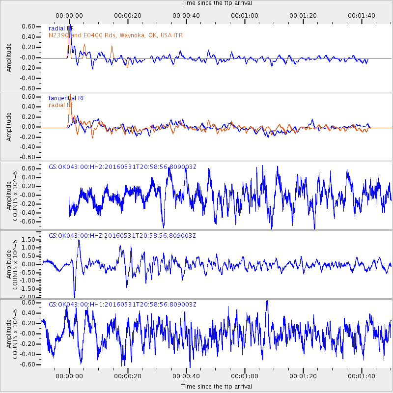
OK043 N2390 and E0400 Rds, Waynoka, OK, USA - Earthquake Result Viewer
*The percent match for this event was below the threshold and hence no stack was calculated.
| Earthquake location: |
Alaska Peninsula |
| Earthquake latitude/longitude: |
55.4/-158.5 |
| Earthquake time(UTC): |
2016/05/31 (152) 20:51:22 GMT |
| Earthquake Depth: |
39 km |
| Earthquake Magnitude: |
5.7 MWW, 5.4 MI, 5.7 MWC, 5.8 MB, 5.8 MWB |
| Earthquake Catalog/Contributor: |
NEIC PDE/NEIC COMCAT |
|
| Network: |
GS US Geological Survey Networks |
| Station: |
OK043 N2390 and E0400 Rds, Waynoka, OK, USA |
| Lat/Lon: |
36.43 N/98.75 W |
| Elevation: |
406 m |
|
| Distance: |
44.2 deg |
| Az: |
89.719 deg |
| Baz: |
315.038 deg |
| Ray Param: |
$rayparam |
*The percent match for this event was below the threshold and hence was not used in the summary stack. |
|
| Radial Match: |
75.886665 % |
| Radial Bump: |
400 |
| Transverse Match: |
61.27871 % |
| Transverse Bump: |
400 |
| SOD ConfigId: |
1475611 |
| Insert Time: |
2016-06-14 20:55:04.249 +0000 |
| GWidth: |
2.5 |
| Max Bumps: |
400 |
| Tol: |
0.001 |
|
Signal To Noise
| Channel | StoN | STA | LTA |
| GS:OK043:00:HHZ:20160531T20:58:56.809003Z | 4.455559 | 7.6531273E-7 | 1.7176582E-7 |
| GS:OK043:00:HH1:20160531T20:58:56.809003Z | 1.7153038 | 3.120185E-7 | 1.8190278E-7 |
| GS:OK043:00:HH2:20160531T20:58:56.809003Z | 2.3247504 | 3.8502506E-7 | 1.6561995E-7 |
| Arrivals |
| Ps | |
| PpPs | |
| PsPs/PpSs | |


