You are here: Home > Network List > TA - USArray Transportable Network (new EarthScope stations) Stations List
> Station E20K Nigu River, AK, USA > Earthquake Result Viewer
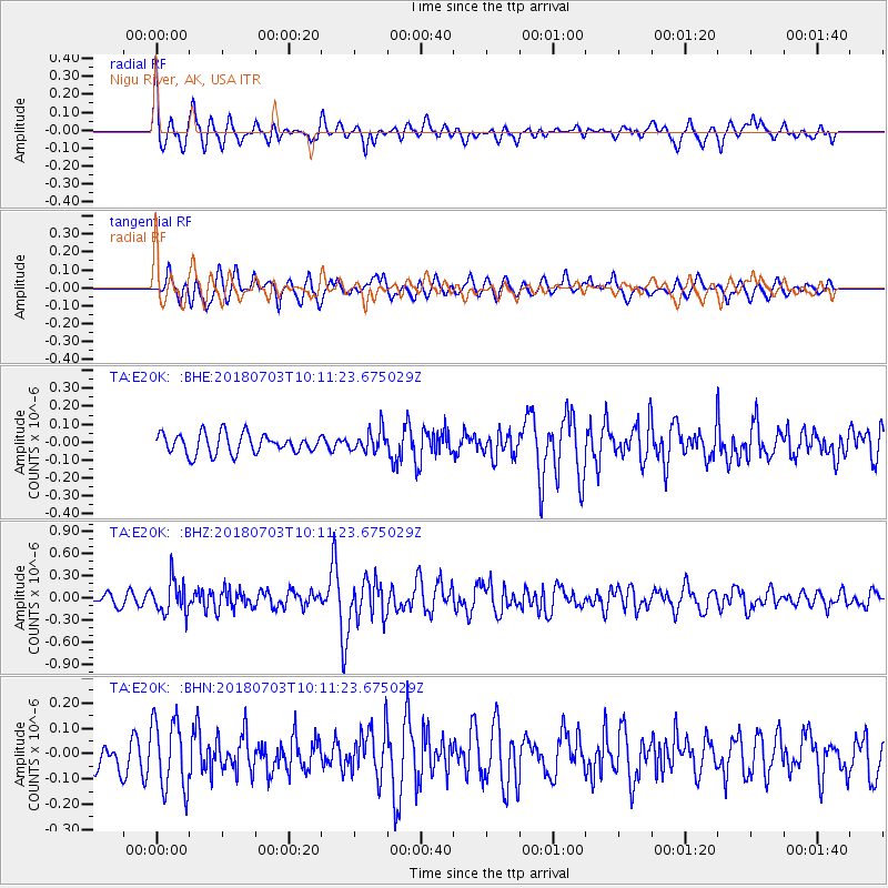
E20K Nigu River, AK, USA - Earthquake Result Viewer
*The percent match for this event was below the threshold and hence no stack was calculated.
| Earthquake location: |
Mindanao, Philippines |
| Earthquake latitude/longitude: |
5.9/125.2 |
| Earthquake time(UTC): |
2018/07/03 (184) 09:59:54 GMT |
| Earthquake Depth: |
100 km |
| Earthquake Magnitude: |
5.6 Mww |
| Earthquake Catalog/Contributor: |
NEIC PDE/us |
|
| Network: |
TA USArray Transportable Network (new EarthScope stations) |
| Station: |
E20K Nigu River, AK, USA |
| Lat/Lon: |
68.26 N/156.19 W |
| Elevation: |
866 m |
|
| Distance: |
80.3 deg |
| Az: |
21.745 deg |
| Baz: |
261.551 deg |
| Ray Param: |
$rayparam |
*The percent match for this event was below the threshold and hence was not used in the summary stack. |
|
| Radial Match: |
73.936264 % |
| Radial Bump: |
400 |
| Transverse Match: |
62.4498 % |
| Transverse Bump: |
400 |
| SOD ConfigId: |
13570011 |
| Insert Time: |
2019-04-30 12:21:24.820 +0000 |
| GWidth: |
2.5 |
| Max Bumps: |
400 |
| Tol: |
0.001 |
|
Signal To Noise
| Channel | StoN | STA | LTA |
| TA:E20K: :BHZ:20180703T10:11:23.675029Z | 3.0737405 | 2.265129E-7 | 7.369292E-8 |
| TA:E20K: :BHN:20180703T10:11:23.675029Z | 2.4398515 | 1.3863709E-7 | 5.682194E-8 |
| TA:E20K: :BHE:20180703T10:11:23.675029Z | 1.0686487 | 5.9587485E-8 | 5.575966E-8 |
| Arrivals |
| Ps | |
| PpPs | |
| PsPs/PpSs | |


