
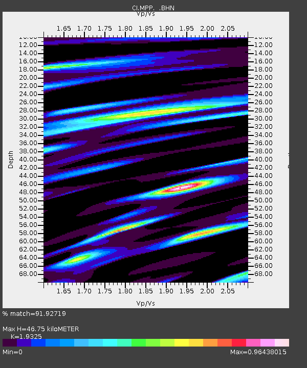
MPP McPhearson Peak - Earthquake Result Viewer
| ||||||||||||||||||
| ||||||||||||||||||
| ||||||||||||||||||
|
Signal To Noise
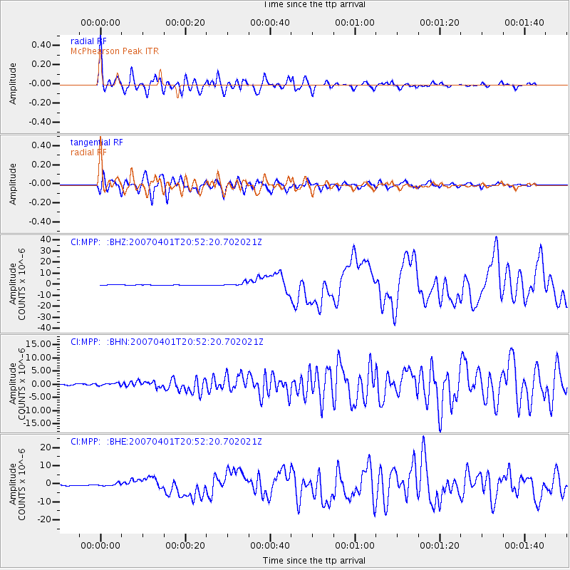
| Channel | StoN | STA | LTA |
| CI:MPP: :BHN:20070401T20:52:20.702021Z | 1.5548631 | 5.130874E-7 | 3.299888E-7 |
| CI:MPP: :BHE:20070401T20:52:20.702021Z | 2.23333 | 7.519236E-7 | 3.3668272E-7 |
| CI:MPP: :BHZ:20070401T20:52:20.702021Z | 7.15649 | 1.6472577E-6 | 2.3017678E-7 |
| Arrivals | |
| Ps | 7.3 SECOND |
| PpPs | 22 SECOND |
| PsPs/PpSs | 29 SECOND |

