
MPP McPhearson Peak - Earthquake Result Viewer
| ||||||||||||||||||
| ||||||||||||||||||
| ||||||||||||||||||
|
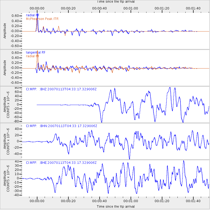
Signal To Noise
| Channel | StoN | STA | LTA |
| CI:MPP: :BHN:20070113T04:33:17.329006Z | 1.5212779 | 8.506081E-7 | 5.591405E-7 |
| CI:MPP: :BHE:20070113T04:33:17.329006Z | 2.683729 | 1.5255152E-6 | 5.684312E-7 |
| CI:MPP: :BHZ:20070113T04:33:17.329006Z | 5.688153 | 2.4915503E-6 | 4.3802453E-7 |
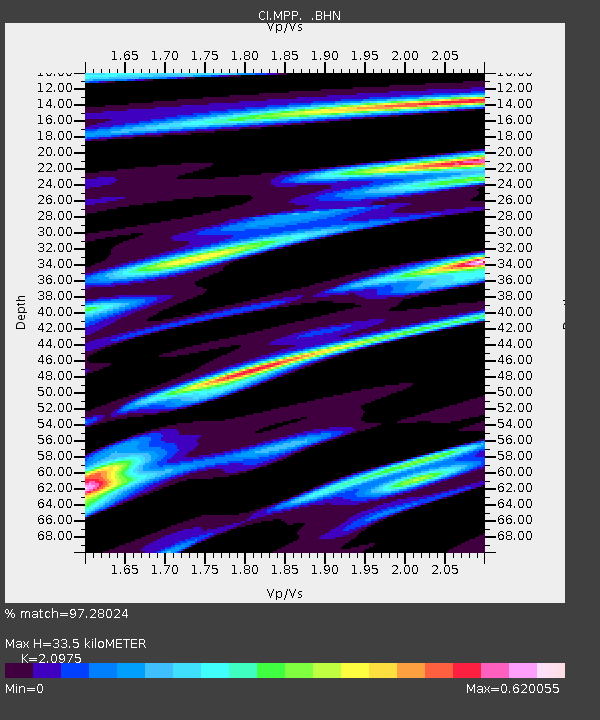
| Arrivals | |
| Ps | 6.2 SECOND |
| PpPs | 16 SECOND |
| PsPs/PpSs | 23 SECOND |

