You are here: Home > Network List > TA - USArray Transportable Network (new EarthScope stations) Stations List
> Station G31M Satah River, YT, CAN > Earthquake Result Viewer
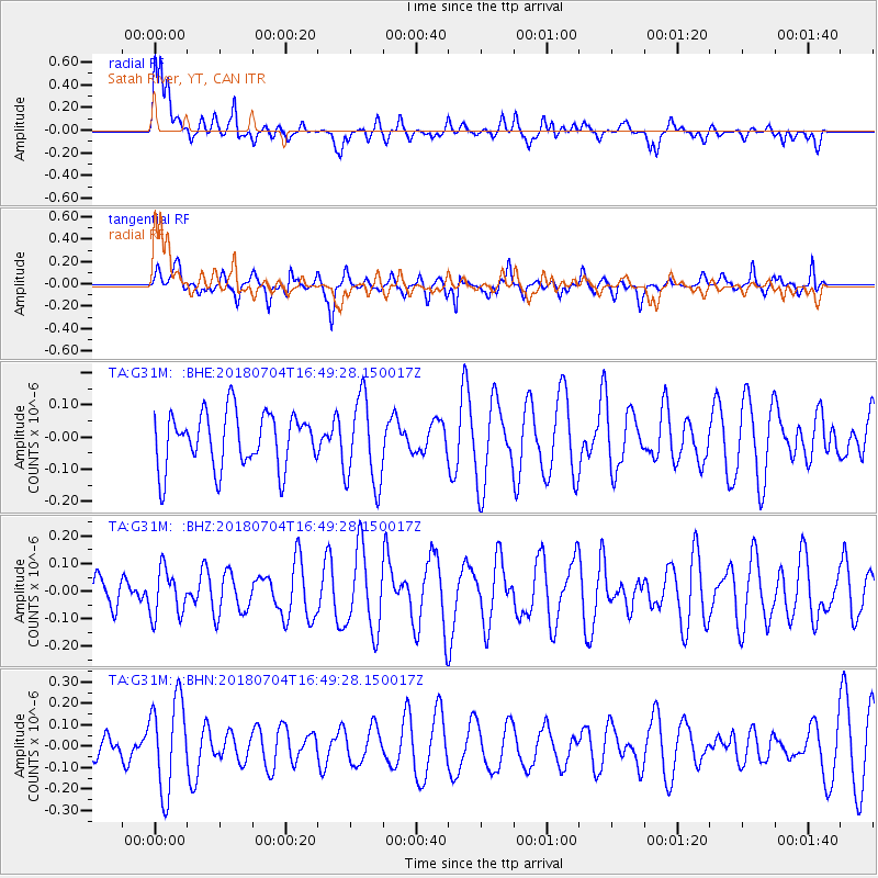
G31M Satah River, YT, CAN - Earthquake Result Viewer
*The percent match for this event was below the threshold and hence no stack was calculated.
| Earthquake location: |
Vanuatu Islands |
| Earthquake latitude/longitude: |
-15.0/167.4 |
| Earthquake time(UTC): |
2018/07/04 (185) 16:37:03 GMT |
| Earthquake Depth: |
113 km |
| Earthquake Magnitude: |
5.5 Mww |
| Earthquake Catalog/Contributor: |
NEIC PDE/us |
|
| Network: |
TA USArray Transportable Network (new EarthScope stations) |
| Station: |
G31M Satah River, YT, CAN |
| Lat/Lon: |
66.92 N/134.27 W |
| Elevation: |
61 m |
|
| Distance: |
92.1 deg |
| Az: |
19.622 deg |
| Baz: |
235.422 deg |
| Ray Param: |
$rayparam |
*The percent match for this event was below the threshold and hence was not used in the summary stack. |
|
| Radial Match: |
60.22172 % |
| Radial Bump: |
400 |
| Transverse Match: |
55.342995 % |
| Transverse Bump: |
341 |
| SOD ConfigId: |
13570011 |
| Insert Time: |
2019-04-30 12:27:50.777 +0000 |
| GWidth: |
2.5 |
| Max Bumps: |
400 |
| Tol: |
0.001 |
|
Signal To Noise
| Channel | StoN | STA | LTA |
| TA:G31M: :BHZ:20180704T16:49:28.150017Z | 1.450417 | 8.449075E-8 | 5.825273E-8 |
| TA:G31M: :BHN:20180704T16:49:28.150017Z | 3.0533774 | 2.1399484E-7 | 7.008463E-8 |
| TA:G31M: :BHE:20180704T16:49:28.150017Z | 1.5964524 | 1.3657329E-7 | 8.5547995E-8 |
| Arrivals |
| Ps | |
| PpPs | |
| PsPs/PpSs | |


