MPP McPhearson Peak - Earthquake Result Viewer
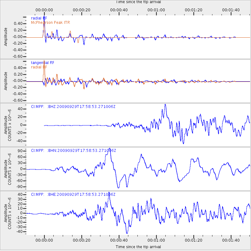
Earthquake location: Samoa Islands Region
Earthquake latitude/longitude: -15.5/-172.1
Earthquake time(UTC): 2009/09/29 (272) 17:48:10 GMT
Earthquake Depth: 18 km
Earthquake Magnitude: 7.1 MB, 8.1 MS, 8.1 MW, 8.0 MW
Earthquake Catalog/Contributor: WHDF/NEIC
Network: CI Caltech Regional Seismic Network
Station: MPP McPhearson Peak
Lat/Lon: 34.89 N/119.81 W
Elevation: 1739 m
Distance: 70.5 deg
Az: 43.617 deg
Baz: 234.004 deg
Ray Param: 0.054924596
Estimated Moho Depth: 16.0 km
Estimated Crust Vp/Vs: 1.60
Assumed Crust Vp: 6.1 km/s
Estimated Crust Vs: 3.812 km/s
Estimated Crust Poisson's Ratio: 0.18
Radial Match: 94.519 %
Radial Bump: 400
Transverse Match: 88.96089 %
Transverse Bump: 400
SOD ConfigId: 2622
Insert Time: 2010-02-26 02:03:32.248 +0000
GWidth: 2.5
Max Bumps: 400
Tol: 0.001

Signal To Noise

ChannelStoNSTALTA
CI:MPP: :BHN:20090929T17:58:53.271006Z8.2849022.9148168E-63.5182273E-7
CI:MPP: :BHE:20090929T17:58:53.271006Z1.46553876.529877E-74.455615E-7
CI:MPP: :BHZ:20090929T17:58:53.271006Z2.81707028.2788137E-72.9388028E-7
Arrivals
Ps1.6 SECOND
PpPs6.6 SECOND
PsPs/PpSs8.2 SECOND