MPP McPhearson Peak - Earthquake Result Viewer
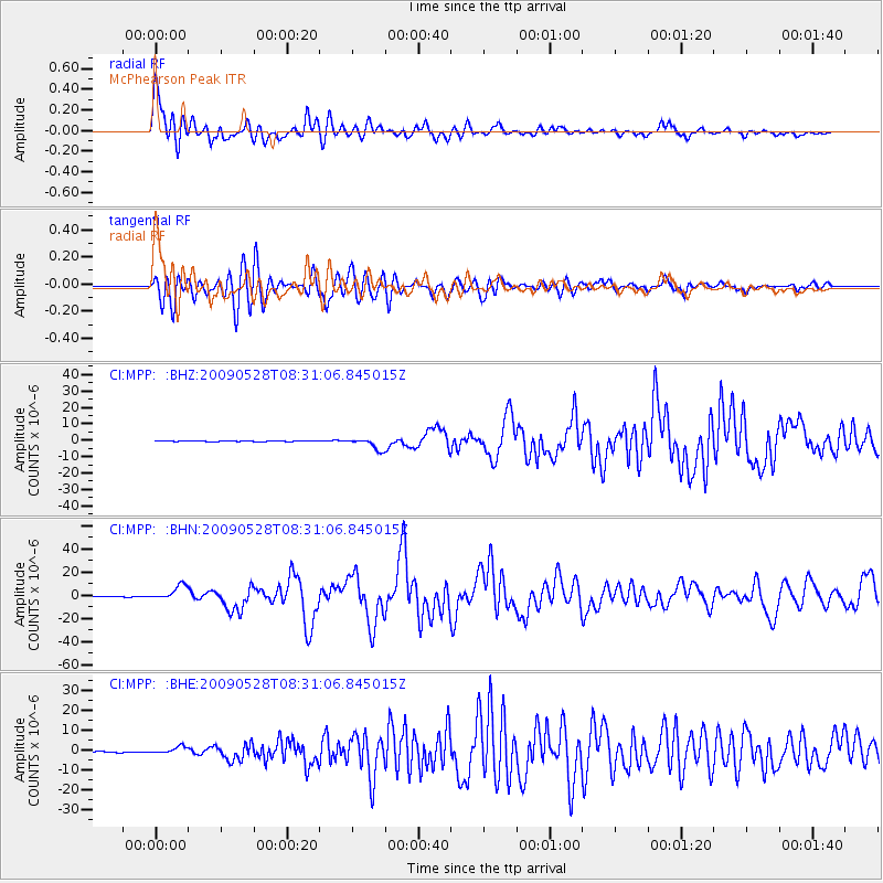
Earthquake location: North Of Honduras
Earthquake latitude/longitude: 16.7/-86.2
Earthquake time(UTC): 2009/05/28 (148) 08:24:45 GMT
Earthquake Depth: 10 km
Earthquake Magnitude: 6.7 MB, 7.2 MS, 7.3 MW, 7.3 MW
Earthquake Catalog/Contributor: WHDF/NEIC
Network: CI Caltech Regional Seismic Network
Station: MPP McPhearson Peak
Lat/Lon: 34.89 N/119.81 W
Elevation: 1739 m
Distance: 35.0 deg
Az: 307.572 deg
Baz: 112.498 deg
Ray Param: 0.07744745
Estimated Moho Depth: 33.75 km
Estimated Crust Vp/Vs: 1.70
Assumed Crust Vp: 6.1 km/s
Estimated Crust Vs: 3.583 km/s
Estimated Crust Poisson's Ratio: 0.24
Radial Match: 91.147415 %
Radial Bump: 400
Transverse Match: 79.946915 %
Transverse Bump: 400
SOD ConfigId: 2648
Insert Time: 2010-02-26 02:03:34.885 +0000
GWidth: 2.5
Max Bumps: 400
Tol: 0.001

Signal To Noise

ChannelStoNSTALTA
CI:MPP: :BHN:20090528T08:31:06.845015Z30.2027746.2184477E-62.0588995E-7
CI:MPP: :BHE:20090528T08:31:06.845015Z7.8447621.7591525E-62.242455E-7
CI:MPP: :BHZ:20090528T08:31:06.845015Z16.6616123.5106666E-62.107039E-7
Arrivals
Ps4.2 SECOND
PpPs14 SECOND
PsPs/PpSs18 SECOND