You are here: Home > Network List > CI - Caltech Regional Seismic Network Stations List
> Station MPM Manuel Prospect Mine, California, USA > Earthquake Result Viewer
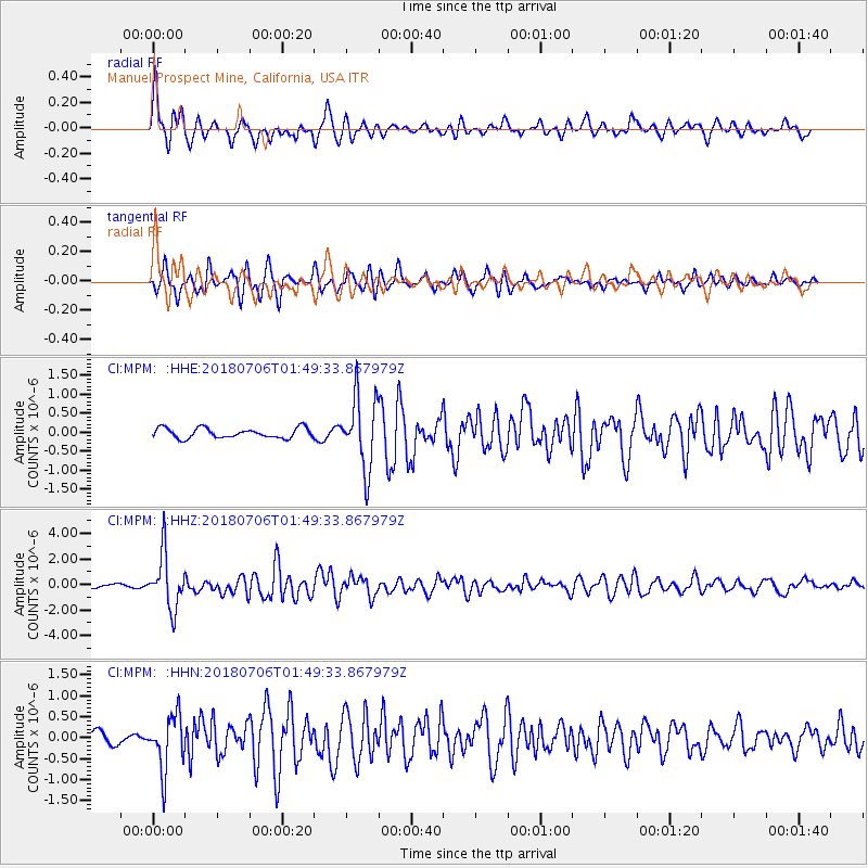
MPM Manuel Prospect Mine, California, USA - Earthquake Result Viewer
*The percent match for this event was below the threshold and hence no stack was calculated.
| Earthquake location: |
Near East Coast Of Kamchatka |
| Earthquake latitude/longitude: |
51.6/157.9 |
| Earthquake time(UTC): |
2018/07/06 (187) 01:40:08 GMT |
| Earthquake Depth: |
80 km |
| Earthquake Magnitude: |
6.1 Mwp |
| Earthquake Catalog/Contributor: |
NEIC PDE/us |
|
| Network: |
CI Caltech Regional Seismic Network |
| Station: |
MPM Manuel Prospect Mine, California, USA |
| Lat/Lon: |
36.06 N/117.49 W |
| Elevation: |
185 m |
|
| Distance: |
59.7 deg |
| Az: |
69.203 deg |
| Baz: |
313.997 deg |
| Ray Param: |
$rayparam |
*The percent match for this event was below the threshold and hence was not used in the summary stack. |
|
| Radial Match: |
77.626915 % |
| Radial Bump: |
400 |
| Transverse Match: |
78.4938 % |
| Transverse Bump: |
400 |
| SOD ConfigId: |
13570011 |
| Insert Time: |
2019-04-30 12:32:55.285 +0000 |
| GWidth: |
2.5 |
| Max Bumps: |
400 |
| Tol: |
0.001 |
|
Signal To Noise
| Channel | StoN | STA | LTA |
| CI:MPM: :HHZ:20180706T01:49:33.867979Z | 11.368584 | 2.1038475E-6 | 1.85058E-7 |
| CI:MPM: :HHN:20180706T01:49:33.867979Z | 4.0595903 | 6.4998954E-7 | 1.6011211E-7 |
| CI:MPM: :HHE:20180706T01:49:33.867979Z | 7.064076 | 9.236705E-7 | 1.3075602E-7 |
| Arrivals |
| Ps | |
| PpPs | |
| PsPs/PpSs | |


