You are here: Home > Network List > US - United States National Seismic Network Stations List
> Station HLID Hailey, Idaho, USA > Earthquake Result Viewer
HLID Hailey, Idaho, USA - Earthquake Result Viewer
*The percent match for this event was below the threshold and hence no stack was calculated.
| Earthquake location: |
Alaska Peninsula |
| Earthquake latitude/longitude: |
55.4/-158.5 |
| Earthquake time(UTC): |
2016/05/31 (152) 20:51:22 GMT |
| Earthquake Depth: |
39 km |
| Earthquake Magnitude: |
5.7 MWW, 5.4 MI, 5.7 MWC, 5.8 MB, 5.8 MWB |
| Earthquake Catalog/Contributor: |
NEIC PDE/NEIC COMCAT |
|
| Network: |
US United States National Seismic Network |
| Station: |
HLID Hailey, Idaho, USA |
| Lat/Lon: |
43.56 N/114.41 W |
| Elevation: |
1772 m |
|
| Distance: |
30.5 deg |
| Az: |
94.244 deg |
| Baz: |
308.575 deg |
| Ray Param: |
$rayparam |
*The percent match for this event was below the threshold and hence was not used in the summary stack. |
|
| Radial Match: |
73.82384 % |
| Radial Bump: |
400 |
| Transverse Match: |
65.98441 % |
| Transverse Bump: |
400 |
| SOD ConfigId: |
1475611 |
| Insert Time: |
2016-06-14 21:00:29.634 +0000 |
| GWidth: |
2.5 |
| Max Bumps: |
400 |
| Tol: |
0.001 |
|
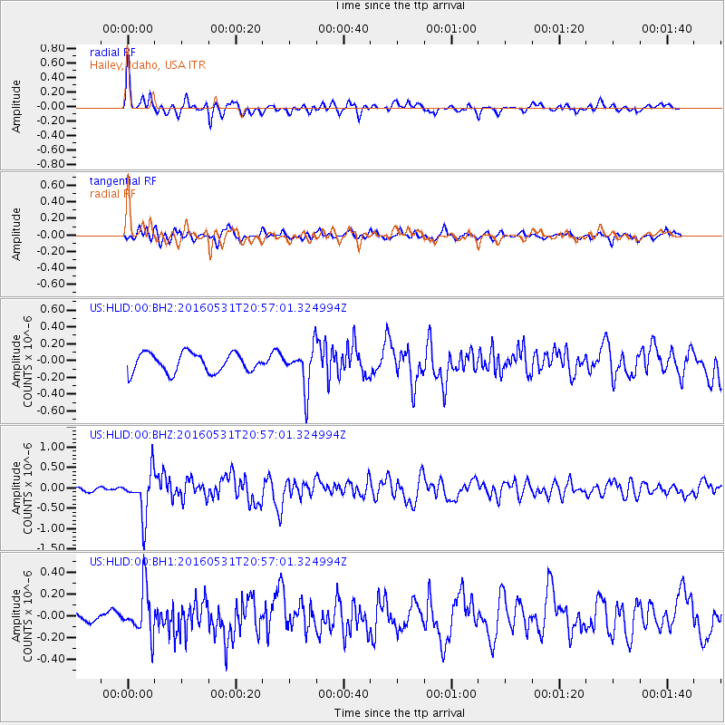
Signal To Noise
| Channel | StoN | STA | LTA |
| US:HLID:00:BHZ:20160531T20:57:01.324994Z | 9.96142 | 5.466227E-7 | 5.4873972E-8 |
| US:HLID:00:BH1:20160531T20:57:01.324994Z | 4.1837406 | 2.1598707E-7 | 5.1625346E-8 |
| US:HLID:00:BH2:20160531T20:57:01.324994Z | 2.1940722 | 2.4701026E-7 | 1.12580736E-7 |
| Arrivals |
| Ps | |
| PpPs | |
| PsPs/PpSs | |


