
MPP McPhearson Peak - Earthquake Result Viewer
| ||||||||||||||||||
| ||||||||||||||||||
| ||||||||||||||||||
|
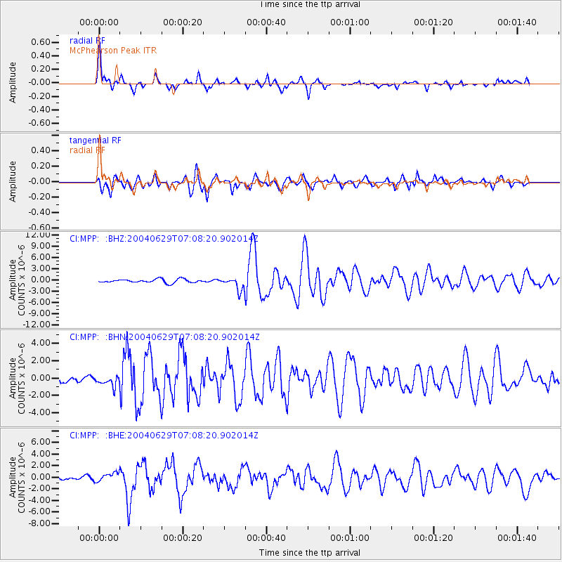
Signal To Noise
| Channel | StoN | STA | LTA |
| CI:MPP: :BHN:20040629T07:08:20.902014Z | 1.6236666 | 6.12848E-7 | 3.7744692E-7 |
| CI:MPP: :BHE:20040629T07:08:20.902014Z | 3.5821126 | 7.598499E-7 | 2.121234E-7 |
| CI:MPP: :BHZ:20040629T07:08:20.902014Z | 3.8053303 | 1.8063184E-6 | 4.7468112E-7 |
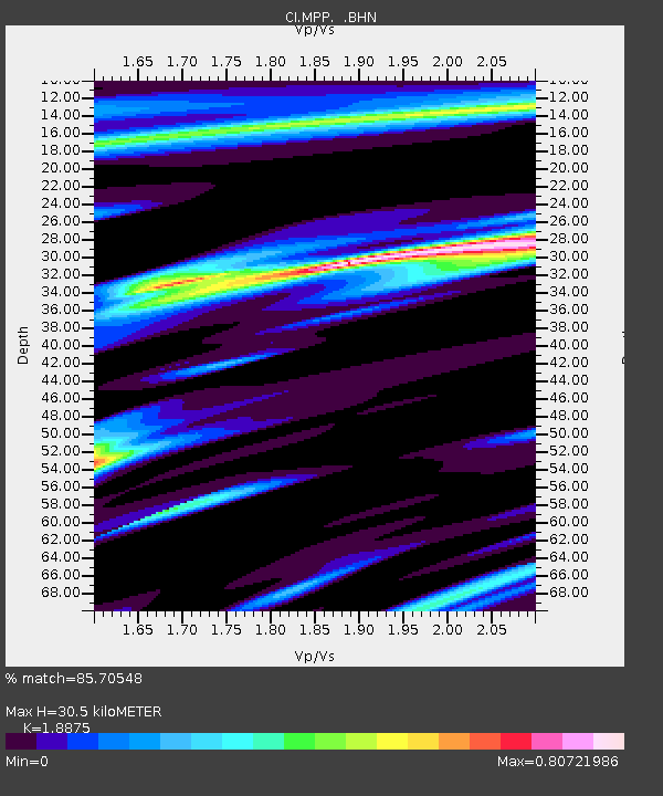
| Arrivals | |
| Ps | 4.7 SECOND |
| PpPs | 14 SECOND |
| PsPs/PpSs | 18 SECOND |

