You are here: Home > Network List > US - United States National Seismic Network Stations List
> Station MNTX Cornudas Mountains, Texas, USA > Earthquake Result Viewer
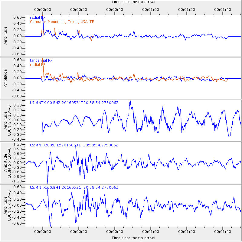
MNTX Cornudas Mountains, Texas, USA - Earthquake Result Viewer
*The percent match for this event was below the threshold and hence no stack was calculated.
| Earthquake location: |
Alaska Peninsula |
| Earthquake latitude/longitude: |
55.4/-158.5 |
| Earthquake time(UTC): |
2016/05/31 (152) 20:51:22 GMT |
| Earthquake Depth: |
39 km |
| Earthquake Magnitude: |
5.7 MWW, 5.4 MI, 5.7 MWC, 5.8 MB, 5.8 MWB |
| Earthquake Catalog/Contributor: |
NEIC PDE/NEIC COMCAT |
|
| Network: |
US United States National Seismic Network |
| Station: |
MNTX Cornudas Mountains, Texas, USA |
| Lat/Lon: |
31.70 N/105.38 W |
| Elevation: |
404 m |
|
| Distance: |
43.9 deg |
| Az: |
100.155 deg |
| Baz: |
318.846 deg |
| Ray Param: |
$rayparam |
*The percent match for this event was below the threshold and hence was not used in the summary stack. |
|
| Radial Match: |
73.99439 % |
| Radial Bump: |
400 |
| Transverse Match: |
68.84848 % |
| Transverse Bump: |
400 |
| SOD ConfigId: |
1475611 |
| Insert Time: |
2016-06-14 21:01:14.476 +0000 |
| GWidth: |
2.5 |
| Max Bumps: |
400 |
| Tol: |
0.001 |
|
Signal To Noise
| Channel | StoN | STA | LTA |
| US:MNTX:00:BHZ:20160531T20:58:54.275006Z | 5.4399157 | 4.543367E-7 | 8.3519076E-8 |
| US:MNTX:00:BH1:20160531T20:58:54.275006Z | 4.2808256 | 3.0630315E-7 | 7.155236E-8 |
| US:MNTX:00:BH2:20160531T20:58:54.275006Z | 1.5347679 | 1.143097E-7 | 7.448013E-8 |
| Arrivals |
| Ps | |
| PpPs | |
| PsPs/PpSs | |


