MPP McPhearson Peak - Earthquake Result Viewer
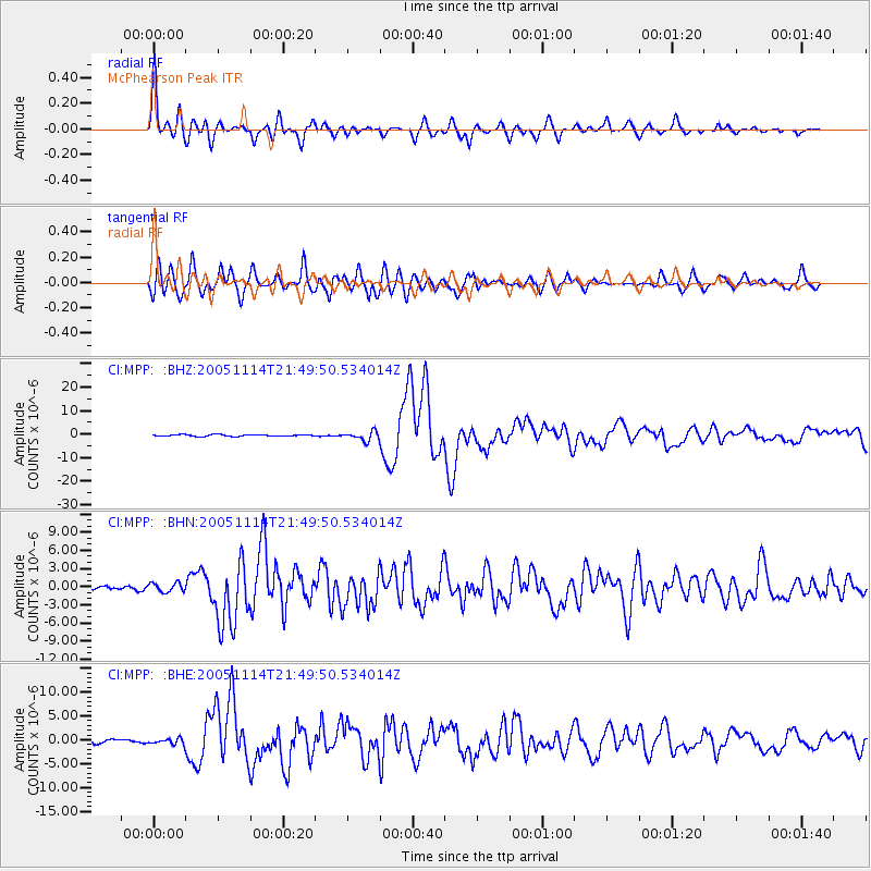
Earthquake location: Off East Coast Of Honshu, Japan
Earthquake latitude/longitude: 38.1/144.9
Earthquake time(UTC): 2005/11/14 (318) 21:38:51 GMT
Earthquake Depth: 11 km
Earthquake Magnitude: 6.7 MB, 6.8 MS, 7.0 MW, 6.9 MW
Earthquake Catalog/Contributor: WHDF/NEIC
Network: CI Caltech Regional Seismic Network
Station: MPP McPhearson Peak
Lat/Lon: 34.89 N/119.81 W
Elevation: 1739 m
Distance: 73.1 deg
Az: 58.799 deg
Baz: 304.834 deg
Ray Param: 0.053202085
Estimated Moho Depth: 42.75 km
Estimated Crust Vp/Vs: 1.87
Assumed Crust Vp: 6.1 km/s
Estimated Crust Vs: 3.271 km/s
Estimated Crust Poisson's Ratio: 0.30
Radial Match: 94.375854 %
Radial Bump: 400
Transverse Match: 88.7293 %
Transverse Bump: 400
SOD ConfigId: 2448
Insert Time: 2010-02-26 02:03:48.870 +0000
GWidth: 2.5
Max Bumps: 400
Tol: 0.001

Signal To Noise

ChannelStoNSTALTA
CI:MPP: :BHN:20051114T21:49:50.534014Z1.23729937.4146215E-75.9925856E-7
CI:MPP: :BHE:20051114T21:49:50.534014Z1.44513426.096643E-74.2187384E-7
CI:MPP: :BHZ:20051114T21:49:50.534014Z5.36130861.9216702E-63.5843306E-7
Arrivals
Ps6.2 SECOND
PpPs19 SECOND
PsPs/PpSs26 SECOND