
R20A Redvale, CO, USA - Earthquake Result Viewer
| ||||||||||||||||||
| ||||||||||||||||||
| ||||||||||||||||||
|
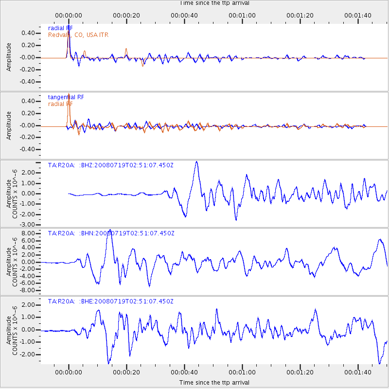
Signal To Noise
| Channel | StoN | STA | LTA |
| TA:R20A: :BHN:20080719T02:51:07.450Z | 7.2328415 | 5.685062E-7 | 7.860067E-8 |
| TA:R20A: :BHE:20080719T02:51:07.450Z | 2.6752243 | 1.4891921E-7 | 5.5666064E-8 |
| TA:R20A: :BHZ:20080719T02:51:07.450Z | 2.770559 | 1.7324257E-7 | 6.252983E-8 |
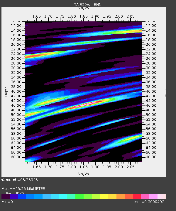
| Arrivals | |
| Ps | 6.4 SECOND |
| PpPs | 20 SECOND |
| PsPs/PpSs | 26 SECOND |

